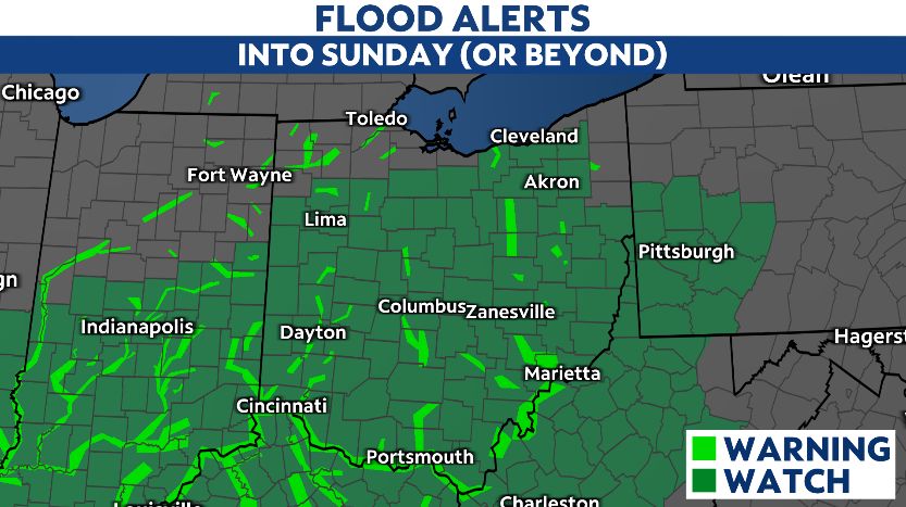
OHIO — Rounds of rain and storms increase the flooding concerns for most of the state through the weekend.
Be prepared for periods of heavy rainfall, along with more strong to severe storms possible.

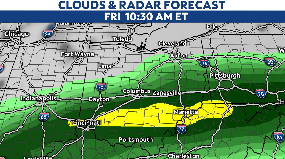
After last night's storms, we will have another round of heavy rain and some storms Thursday afternoon and night. Most of the heavy precipitation and severe weather threat is along I-70 and southbound. While rainfall totals will be lower, more showers are still likely as far north as US-30.

A stalled frontal boundary remains in southern Ohio through Friday, keeping rounds of heavy rain in the forecast.
By Friday night the boundary lifts north which will bring a higher chance of rain in northern Ohio for the weekend.
If you have plans Saturday or Sunday, you may want to plan ahead to cancel as rain is likely all weekend. Heavy rainfall at times and some storms possible again Saturday. As we head toward Sunday we will begin to cool off with scattered showers still possible.
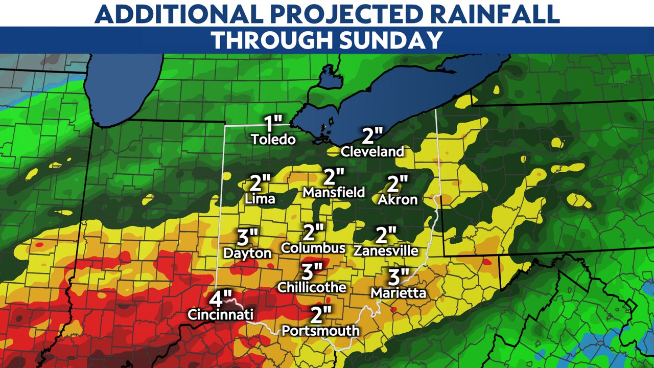
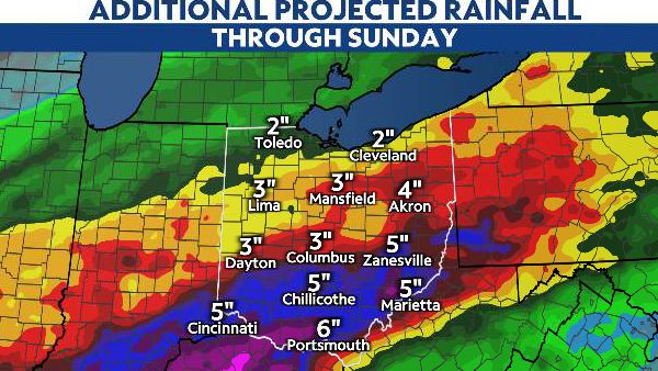
By Sunday our local rainfall totals could reach 3 to 5 inches, and highs totals are possible in southern Ohio where we could push over 5 to 7+ inches of rain.
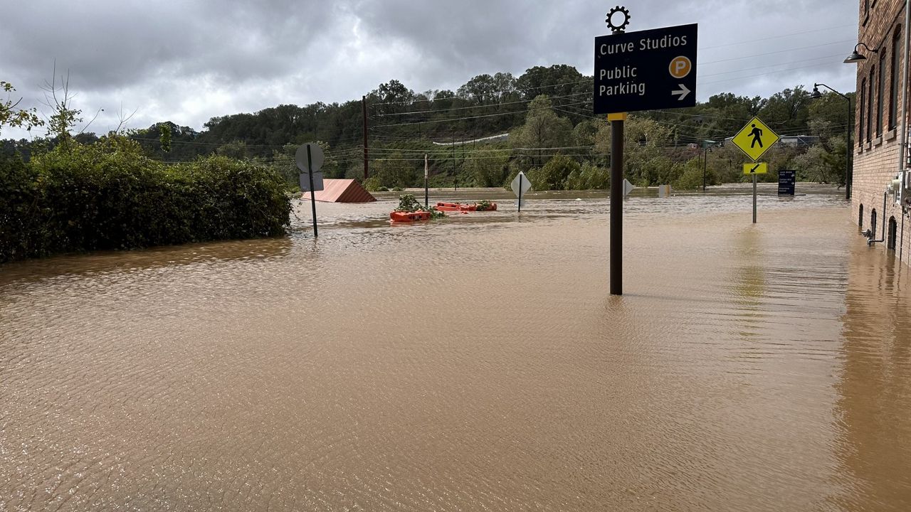
Flooding is a big concern, and potentially flash flooding at times as our ground is exceptionally saturated already.
Before a flood, it is important to stay informed, determine what areas are more likely to flood including roadways. It is key to have a plan in place in case these areas are impacted during the event.
During a flood, always get to higher ground, and stay connected for weather updates. Avoid floodwater: it is NEVER safe to drive or walk through them. Remember turn around, don't drown.