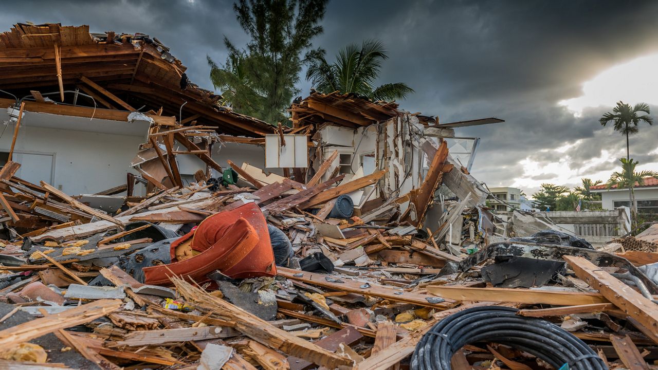
The peak of hurricane season is behind us, but that doesn’t mean Tampa Bay is out of the woods yet.
In fact, Tampa is more likely to experience a hurricane during the month of October than any other time of the year.
Some may call October Tampa’s “true hurricane season” because of its historical track record of October hurricanes. Many of these hurricanes originate over the Caribbean Sea, a known hot spot for tropical formation this time of year.
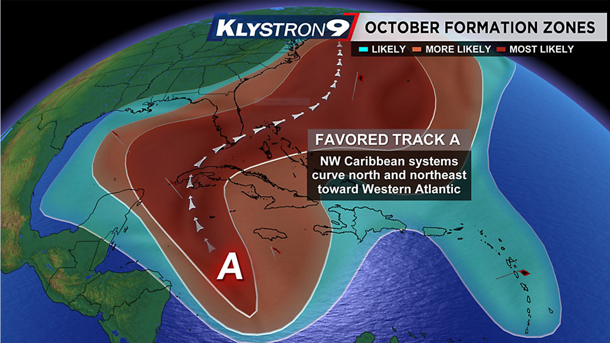
Conditions are most favorable for tropical development in the Caribbean this time of year than any other spot in the Atlantic. That doesn’t mean development can’t happen elsewhere but we really look at the Caribbean Sea with a magnifying glass this time of year.
The reason has to do with tropical waves interacting with strong cold fronts that move off the Florida coast. These cold fronts tend to stall near Cuba or near the Caribbean Sea and are known to spin up tropical activity.
A stalled out front over Florida can act like a corridor for hurricanes to track along them. Often times, tropical cyclones develop over the western Caribbean Sea and track north into the Gulf of Mexico where they begin to turn east, toward Florida.
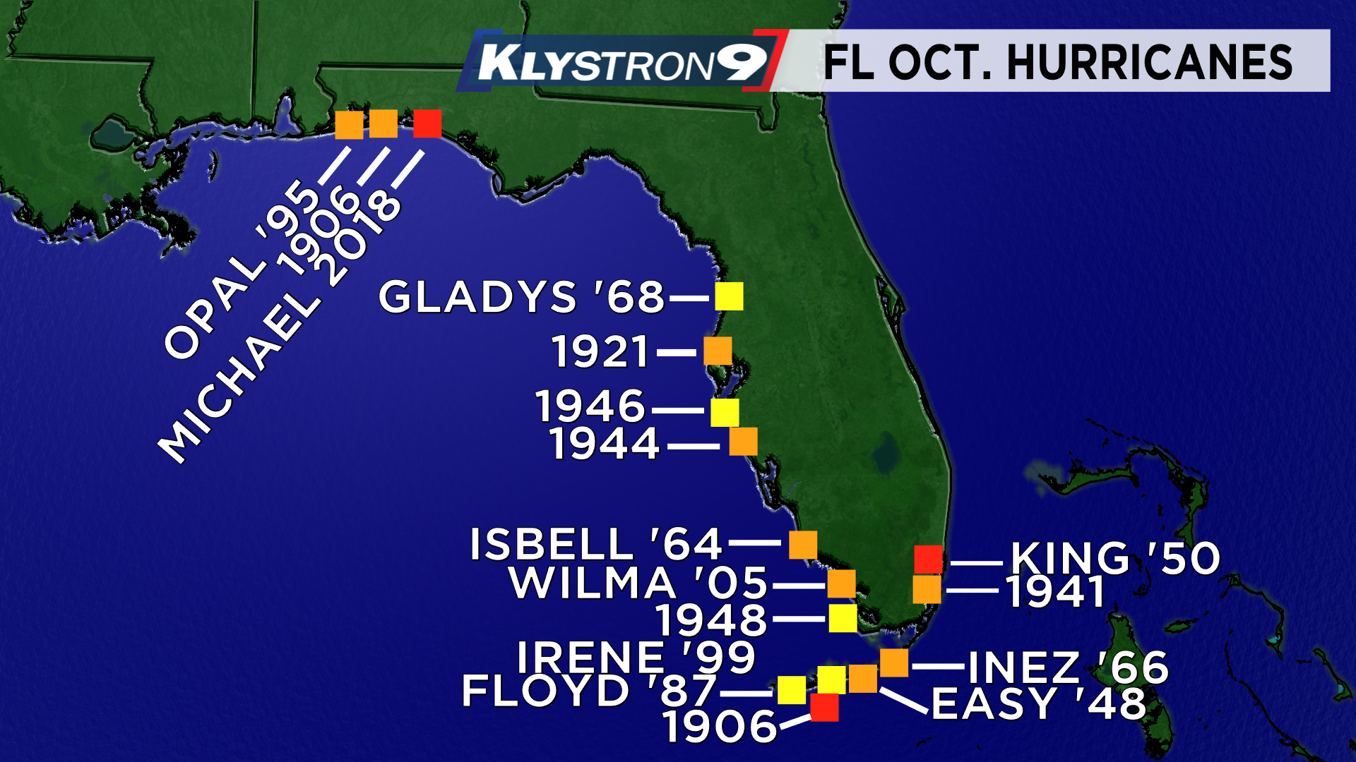
While this doesn’t always happen, history says it is the most probable solution. Since 1851, a total of 33 October hurricanes have made landfall on the Florida Coast, and 10 of those were major hurricanes. An overwhelming number of those hurricanes made landfall on Florida’s West Coast.

Some of the most notable October hurricanes to strike our area include the 1921 Tampa Bay Hurricane. It is also known as the 1921 Tarpon Springs Hurricane as it made landfall as a Category 3 near Tarpon Springs on Oct. 25.

The 1921 Tampa Bay Hurricane was the last major hurricane to directly impact Tampa Bay. It caused a tremendous amount of damage and an 11-foot storm surge inundated parts of the Bay Area. Parts of Pinellas County became an island and breaking waves were reported near the streets of Ybor City. The sea wall on Bayshore also faced severe damage.
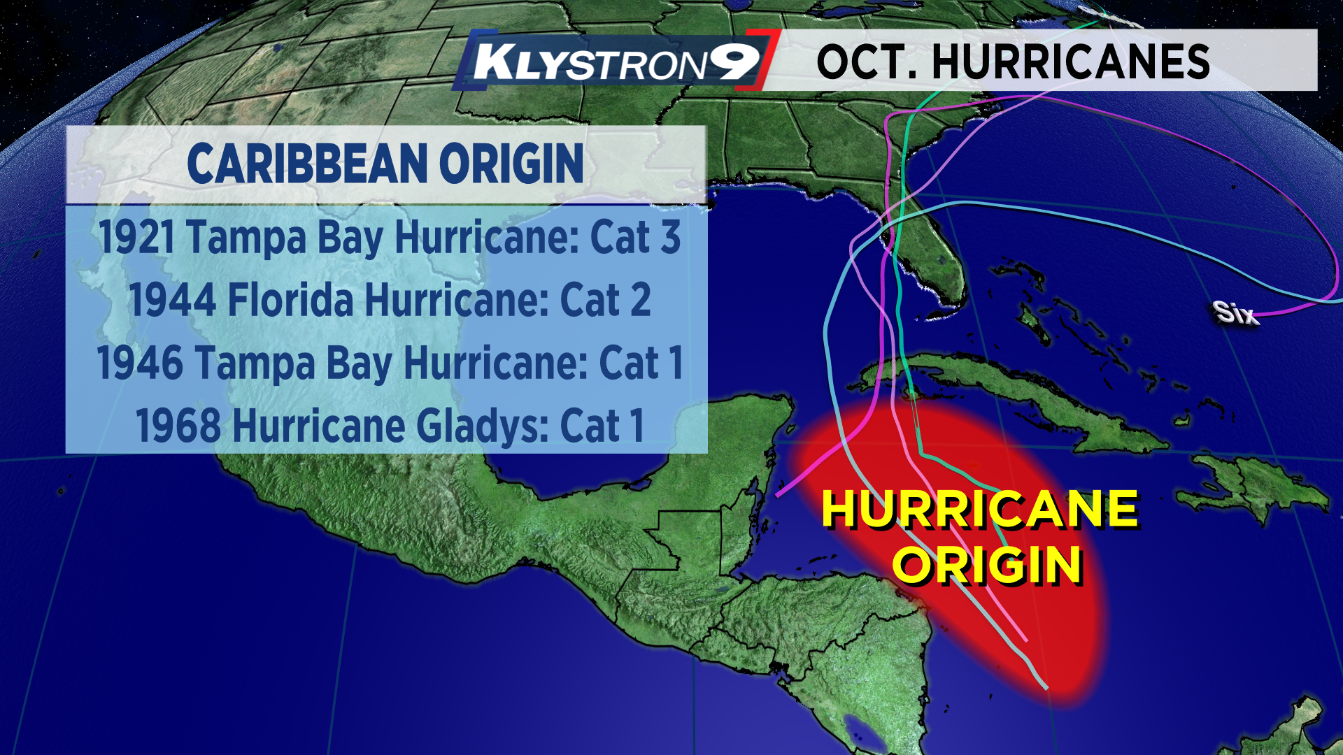
Just like the 1921 Tampa Bay Hurricane, the 1944 Cuba-Florida hurricane developed over the same region. On October 18, the hurricane slammed right into Sarasota as a Category 2 hurricane. Just two years later, the Tampa Bay Hurricane of 1946 made landfall just south of St. Petersburg as a Category 1.
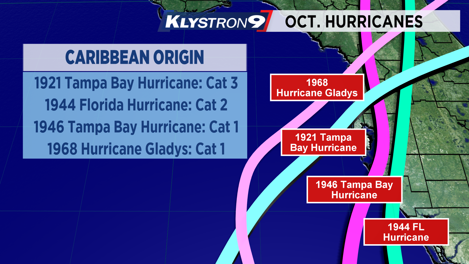
You can’t forget about Hurricane Gladys that struck Homosassa in 1968 with winds of 85 mph. A fun fact about Hurricane Gladys is it was the first hurricane in the Atlantic to be observed by the Hurricane Hunters, satellite and radar at the same time.
All four hurricanes that struck Tampa Bay during the month of October developed over the same region, followed a similar track and made landfall over the west Florida coast.
We know a hurricane will strike again and history leans toward October for Tampa Bay. That is why it is important to monitor the forecasts this time of year, especially as cold fronts start moving south toward the Caribbean.


