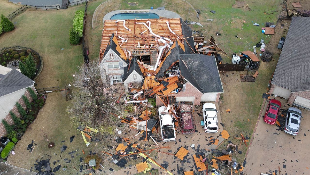
Ian became the ninth named storm of the 2022 Atlantic hurricane season and the fourth hurricane on the season too on the evening of Sept. 23. Even though it was slow to strengthen, Ian underwent rapid intensification once it become a hurricane on Sept. 25.
Hurricane Ian made landfall in southwest Florida on Sept. 28, the first hurricane to make landfall in the continental U.S. this year.
Its first landfall was just after 3 p.m. on Cayo Costa, Fla. with max winds of 150 mph. After that, it made a second landfall as it moved inland just south of Punta Gorda near Pirate Harbor, with max winds of 145 mph.
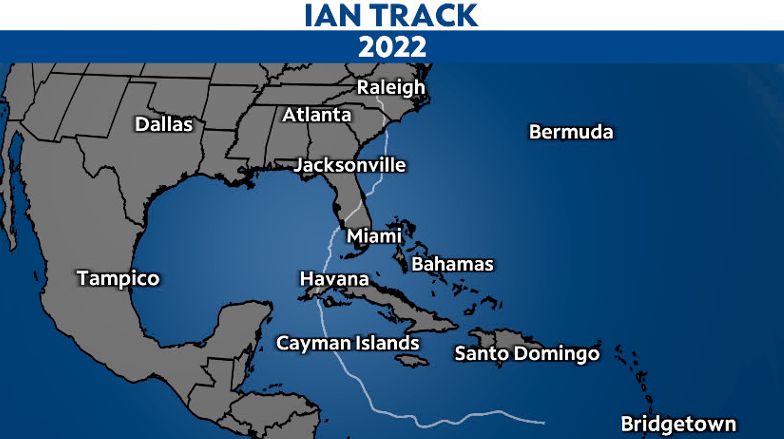
Ian made its third landfall in the U.S. (fourth landfall including Cuba) shortly after 2 p.m. on Friday, Sept. 30, 2022, near Georgetown, S.C. At the time, it was a Category 1 hurricane, with maximum sustained winds of 85 mph.
Ian weakened after making landfall and moving across Florida, but had the opportunity to strengthen back into a hurricane over the Atlantic Ocean.
After its fourth and final landfall on Sept. 30, it quickly weakened.
Ian hit the Carolinas on Sept. 30 after devastating large portions of the Florida peninsula.
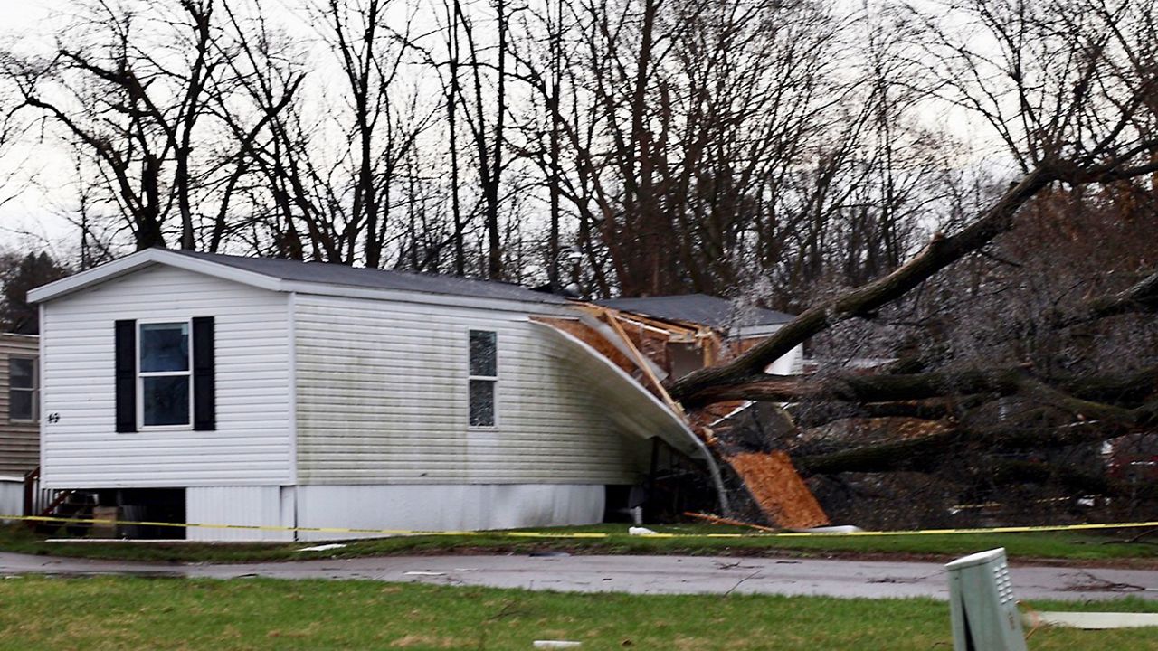
After making its fourth landfall Friday as a Category 1 hurricane near Georgetown, South Carolina, Ian pushed through North Carolina with heavy rains and gusty winds, downing trees and leaving hundreds of thousands of North Carolina residents without power.
See the rest of damage from North Carolina.
In Florida, a weather station near Port Charlotte reported a sustained wind of 115 mph, with a wind gust of 132 mph, as Ian made landfall
Parts of southwest Florida, including Naples, were inundated with high water on Sept. 28 as Ian came ashore.
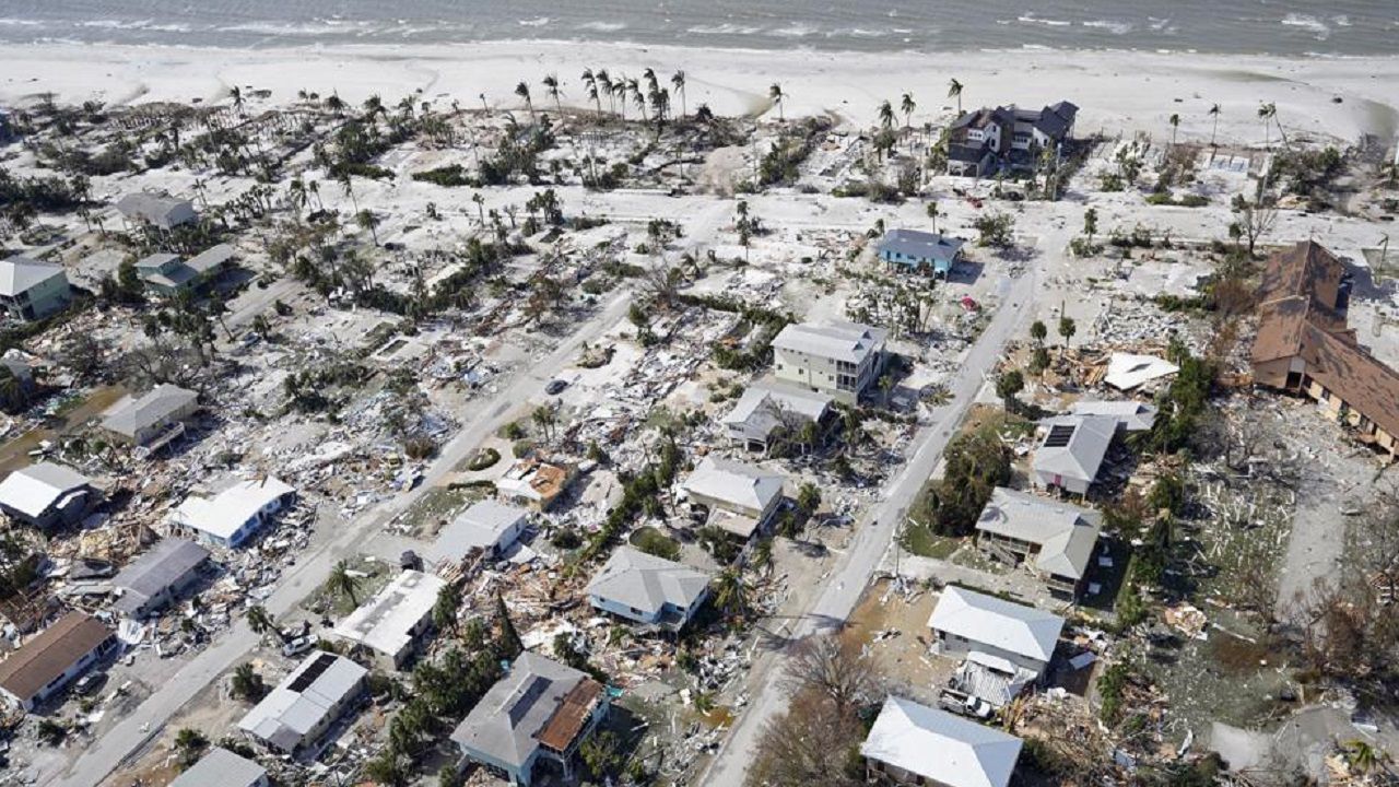
Surge was highest near Ian's center, and considerably lower farther north toward Tampa Bay.
Parts of southwest Florida reported storm surge up to 12 to 18 feet inundation in spots.
Sanibel Island saw waters rise extremely quickly as Ian made its way onshore.
Areas of Central Florida had a deluge of rain with numerous locations getting over a foot. That caused widespread flooding, prompting dozens of water rescues.
See what the damage looked like throughout Florida.
After making landfall and traveling across the Florida peninsula, Ian weakened into a tropical storm over land. Once it moved back over the Atlantic off the east coast of Florida, it had an opportunity to strengthen back into a hurricane.
Ian moved north, and made its third landfall in the U.S. as a Category 1 hurricane with max winds of 85 mph. It moved inland near Georgetown, S.C. just after 2 p.m. on Friday, Sept. 30.
Cuba
Before hitting the U.S., Ian made landfall as a major hurricane just southwest of La Coloma, Cuba, a town in the Pinar del Rio Province around 4:30 a.m. on Sept. 27.

Ian weakened slightly after passing over western Cuba, but still maintained its major hurricane status as it moved north into the Gulf. After completing an eyewall replacement cycle on Sept. 27, Ian became a Category 4 hurricane early on Sept. 28.
See how the 2022 Atlantic hurricane season has gone so far.


