


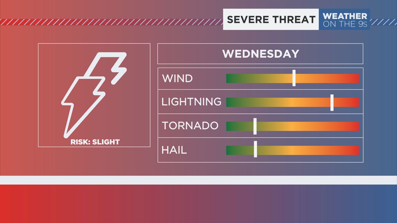
A line of thunderstorms will move though the area today with a cold front. Some thunderstorms could be severe.
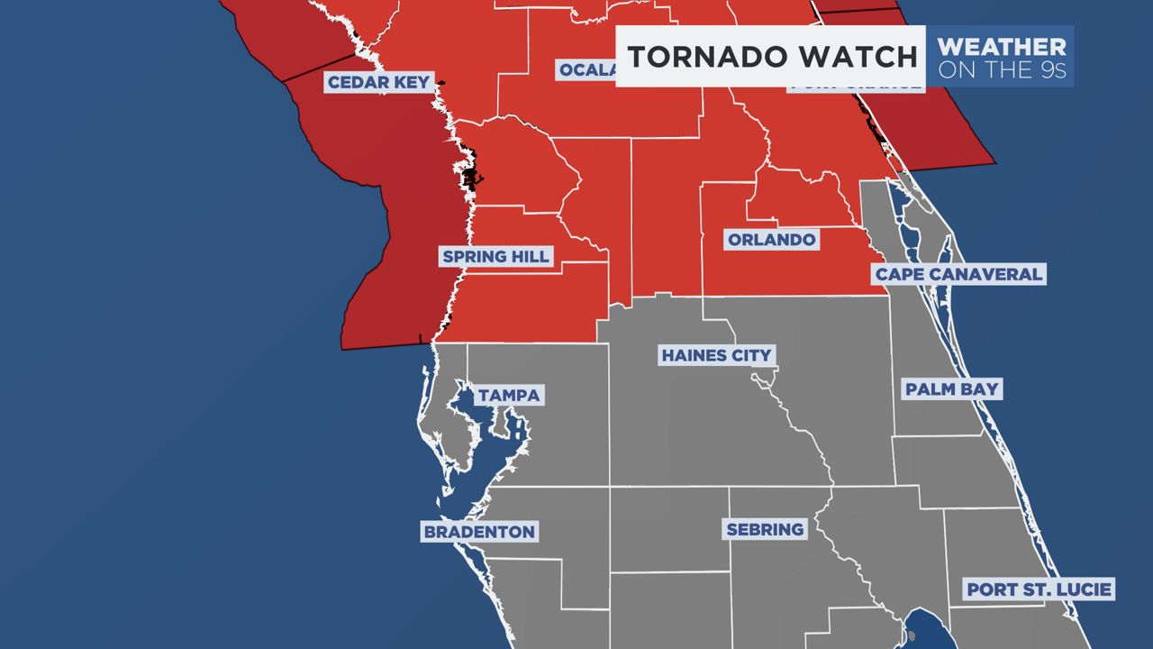
A brief tornado or two will be possible this afternoon, particularly north of Tampa.
Rainfall amounts will be around 1 inch for most, but some could see even more.
A Wind Advisory is in effect from 11 a.m. - 4 p.m. for winds of 20-30 mph with gusts to 50 mph.
This line of storms will cross the area between 12 p.m. and 6 p.m..
We'll see some leftover showers tonight, but skies will gradually clear through the day on Thursday.
Temperatures will cool down to below normal for the end of the week and into the weekend.
Our team of meteorologists dives deep into the science of weather and breaks down timely weather data and information. To view more weather and climate stories, check out our weather blogs section.