


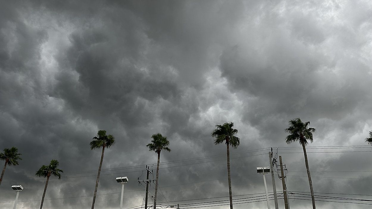
A Tornado Watch is in effect for the Bay area until 3 p.m.
A cold front will bring a line of thunderstorms through the area on Thursday.
Storms will begin to approach the Nature Coast around 11 a.m. to noon.
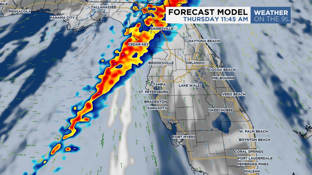
Then, this line will move south toward the Tampa Bay area between 2 p.m. and 3 p.m.
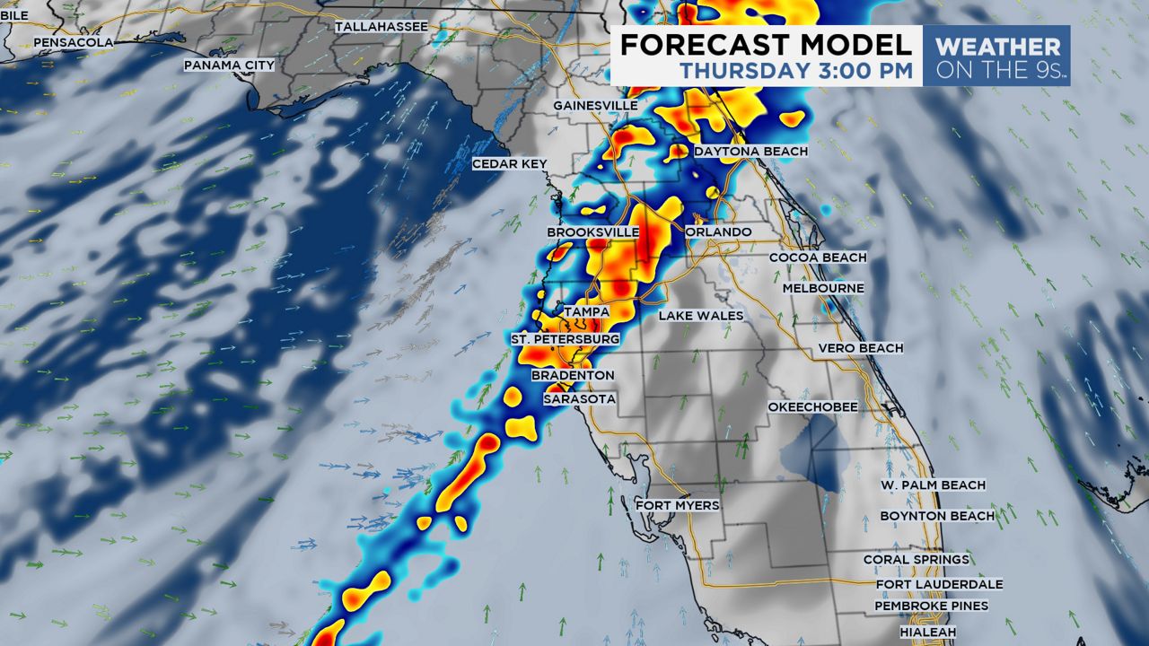
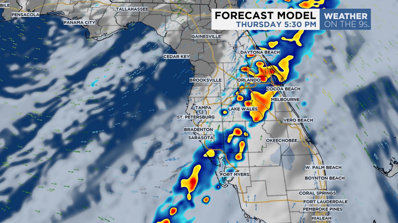
From there, it will move through Polk and Manatee counties between 3 p.m. and 6 p.m.
Overall, the risk of severe thunderstorms is low, with the main concern being strong wind gusts. Some wind gusts could exceed 40 mph as this line moves through.
)
An isolated tornado or two is possible within this line, but is generally a lower risk.
Some coastal flooding is possible, particularly during the afternoon high tide as a steady south wind pushes water against the shore.
Two to four feet of water rise is possible from coastal Pasco County and north, while one to three feet of rise is possible for coastal Pinellas, Hillsborough, and Manatee counties.
As a result, a coastal flood watch is in effect for the area.
Rainfall amounts will generally be around a half an inch with locally higher amounts.
Inland flooding is not a big concern. Even though the rain will be heavy at times, the line will move through quickly.
Make sure to have multiple ways to receive alerts, just in case.
Get alerts and live weather coverage on the go with the Spectrum News App.
Skies will gradually clear out Thursday night with beautiful weather returning for Friday and the weekend.
Our team of meteorologists dives deep into the science of weather and breaks down timely weather data and information. To view more weather and climate stories, check out our weather blogs section.