We're in for pleasant weather across North Carolina through the end of the workweek, but we all need to keep a close eye on the weekend outlook.
A potent storm system will develop across the central part of the country at the end of this week. As that system tracks to the east into the weekend, it will tap into Gulf moisture, producing strong storms starting in areas around Missouri and Illinois late Friday.
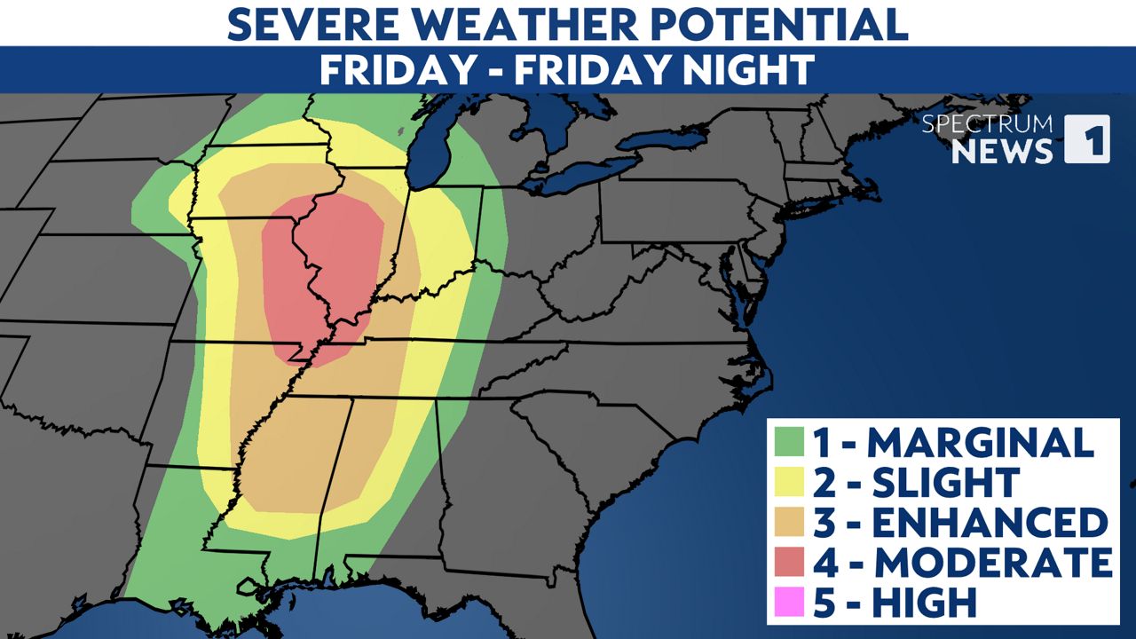
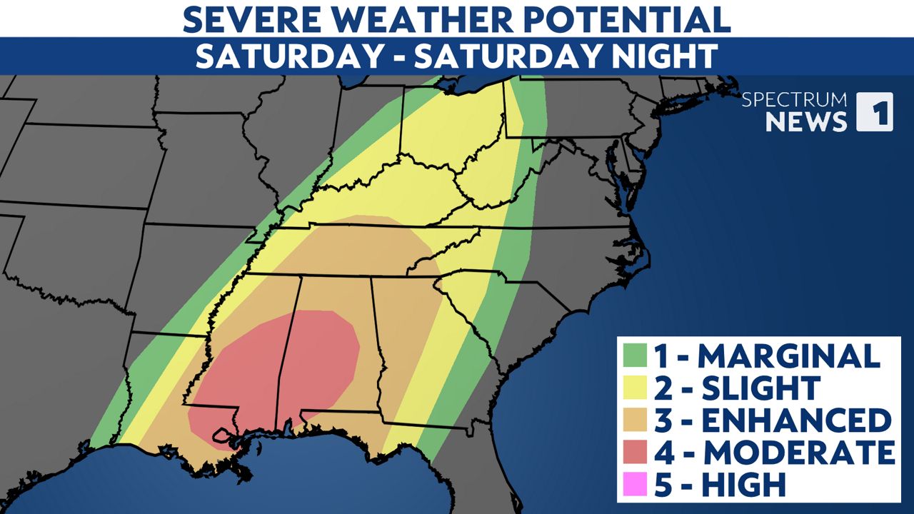
The severe weather threat will shift to the south Saturday with the highest threat for locations in and around Mississippi and Alabama. Forecast data shows concerning signs for what could be a widespread severe outbreak including strong tornadoes in that part of the country.
As the storm system moves to the east, the severe weather threat should not be quite as high here in the Carolinas, but strong storms will be possible.
Western parts of North Carolina could see some of the storms late Saturday night into early Sunday.
A line of storms is expected to track to the east across the state through Sunday. The line may not move off the coast until late Sunday night or early Monday.
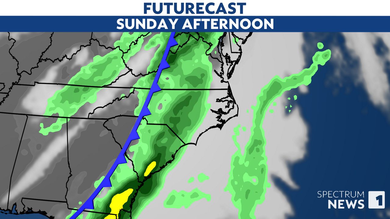
Heavy rain will be possible along that line with embedded thunderstorms that could produce strong wind gusts.
Since Sunday is still four days away, the Storm Prediction Center has not yet issued a detailed severe weather outlook for the area. That will be available on Friday.
However, we expect the greatest threat from the storms will come from damaging straight-line wind gusts. A low tornado risk cannot be ruled out.
Stay tuned to Spectrum News 1 and the Spectrum News app for updates.
Our team of meteorologists dives deep into the science of weather and breaks down timely weather data and information. To view more weather and climate stories, check out our weather blogs section.