TALLAHASSEE, Florida — Michael's leading edge careened onto northwest Florida’s white-sand beaches as a still-growing Category 4 hurricane Wednesday, lashing the coast with tropical storm-force winds and rain and pushing a storm surge that could cause catastrophic damage well inland once it makes landfall.
The unexpected brute quickly sprang from a weekend tropical depression with top winds growing to 145 mph, the most powerful hurricane in recorded history for this stretch of the Florida coast.
Florida officials continue to monitor the storm.
- President Trump approves Florida Emergency Declaration
- Gov. Scott issues state of emergency for Florida Gulf Coast
- Citrus County to issue immediate evacuations
- Hernando County issues voluntary evacuations
- JUMP TO: Live updates from Tampa area officials ▼
- RELATED: Where to Find Sandbags in the Tampa area
- Bay News 9: Tropical Storm watch issued from Suwanee River to Anna Maria Island
- News 13: TROPICS: TS Michael Almost Hurricane; Central Florida To Feel Its Winds
- TRACKING THE TROPICS: Watches, warnings, forecasts, spaghetti models
On Sunday, Gov. Rick Scott issued a state of emergency for 35 counties along the Florida Gulf Coast, which includes most of the counties in the Tampa Bay area:
- Citrus
- Hernando
- Pasco
- Pinellas
- Hillsborough
- Manatee
Scott also directed the Florida Department of Transportation to suspend tolls immediately in the northwest Florida region. Tolls will be suspended at the following facilities:
- Mid-Bay Bridge and Spence Parkway (Okaloosa County)
- Garcon Point Bridge (Santa Rosa County)
- Bob Sikes Toll Bridge (Escambia County)
- Orchard Pond Parkway (Leon County)
"Let's all stay safe and watch this storm closely," Scott tweeted. "As we have seen before, it can change direction and impact any part of our state."
On Wednesday, President Trump approved a request from state lawmakers to issue a Emergency Declaration for Florida. The action authorizes the Department of Homeland Security and FEMA to coordinate all disaster relief efforts in the state.
Following that declaration, Health and Human Services Secretary Alex Azar declared a public health emergency in Florida. The declaration provides greater flexibility for Medicare and Medicaid beneficiaries and their providers in meeting emergency health needs.
The Florida Supreme Court, District Court of Appeals, and other courts in the Panhandle are also closing Tuesday through Thursday because of the storm.
The Port of Pensacola and Port of Panama City have closed.
Currently, 34 shelters throughout the affected area are open or are mobilizing to open. Visit https://www.floridadisaster.org/shelter-status/ to find information on shelters in your area.
Once a state of emergency is declared, state and local agencies start preparing resources ahead of the storm.
The Florida Department of Transportation is coordinating with utility companies to expedite pre/post storm clean-up activities. As of 7:10 p.m. Tuesday, more than 17,000 power restoration personnel have been pre-positioned to help residents who lose power during the storm.
Citrus County
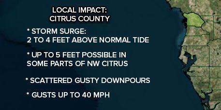
Citrus County is worried about flooding, with an 8-12 foot storm surge happening.
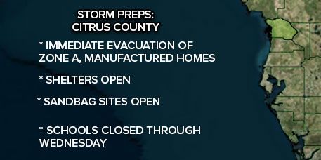
A mandatory evacuation order is now in effect for Zone A homes. Find out what zone you are in on the Citrus County website. RVs and manufactured homes for the whole county are also under mandatory evacuation orders.
Shelters will open for those residents starting Tuesday at 9 a.m.
Those locations are:
- General population:
Lecanto Middle School
Citrus High School - Pet-friendly:
Lecanto Primary School - Special Needs:
Forest Ridge Elementary
Citrus County School District has closed schools for Tuesday and Wednesday. Other school districts are monitoring conditions right now.
Hernando County
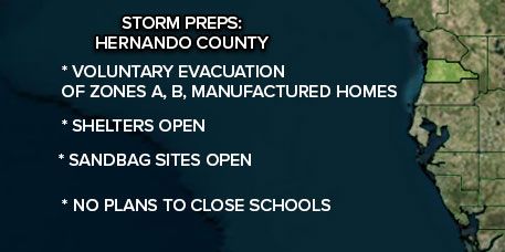
Hernando County has a voluntary evacuation order for zone levels A and B, starting at 8 a.m. This area includes low-lying areas west of of U.S. 19 and manufactured homes. Head to the Hernando County website to see if you home is affected.
The county will open a shelter Tuesday at noon at The Enrichment Center on 800 John Gary Grubbs Blvd. in Brooksville. The shelter is meant to help people with special needs, people with pets, as well as the general population.
Pasco County
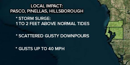
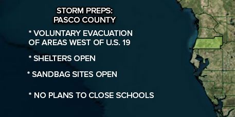
Pasco County is monitoring the storm and has opened some sandbag locations along the coast.
Pasco County Emergency Management is recommending voluntary evacuations for certain residents of Pasco County, as potentially life-threatening storm surge from Hurricane Michael is expected to occur along the county's Gulf coast overnight Tuesday into Wednesday evening. Vulnerable coastal areas are expected to be impacted regardless of the storm's exact track or strength.
The following residents should evacuate:
- Anyone living west of U.S. 19 in areas vulnerable to potential storm surge
- Special Needs Residents living west of U.S. 19
- Anyone in low-lying areas along rivers or inland areas that have experienced flooding in the past
- Anyone living in a building that has experienced flooding following heavy rain events.
The recommended evacuation map for those residents vulnerable to storm surge can be viewed here.
Residents should first attempt to find shelter with neighbors, relatives or friends. If that is not an option, residents can self-evacuate directly to the Fasano Regional Hurricane Shelter, located at 11611 Denton Avenue in Hudson. The pet-friendly shelter will open Tuesday, October 9 at 12 p.m. for anyone who would like to leave their home ahead of Hurricane Michael.
Pasco County residents can call the Pasco County Customer Service line with any questions or concerns at 727-847-2411. Customer Service is open 24-hours a day, until further notice.
Pinellas County
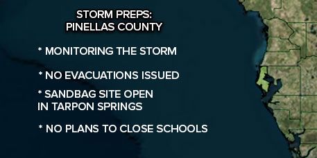
Pinellas County is monitoring the storm.
Hillsborough County
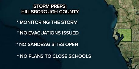
Hillsborough County is monitoring the storm.
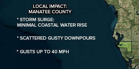
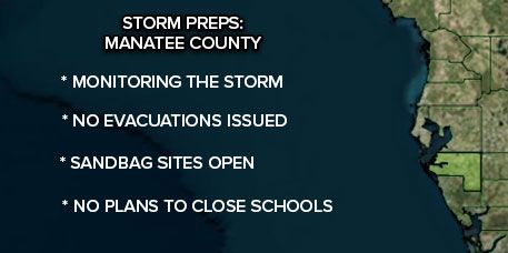
Manatee County
Manatee County is monitoring the storm.
The Florida National Guard is activating 500 guardsmen to help with planning and logistics as people prepare.
The State Emergency Operations Center is now operating at Level 1, according to the governor's office.


