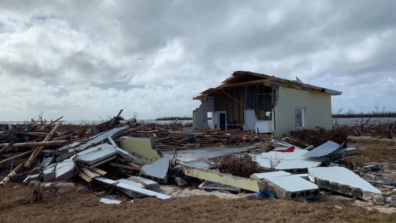
NORTH CAROLINA — Hurricane Dorian battered the North Carolina coast Thursday night into Friday morning as residents hunkered down. By Friday morning, the hurricane made landfall.
9 a.m. Friday update:
Hurriance Dorian made landfall over Cape Hatteras in North Carolina at 8:35 a.m. Maximum sustained winds were estimated at 90 mph.
8 a.m. Friday update:
Hurricane Dorian moved into the Outer Banks in earnest Friday morning, and as of 8 a.m. was located about 10 miles west-southwest of Cape Hatteras. It has sustained winds of 90 mph and is moving northward at 14 mph. The good news is hte Hurricane Warning and Tropical Storm Warning have been discontinued for Surf City in North Carolina.
In addition, the Storm Surge Warning south of Salter Path, North Carolina, has been discontinued.
NCDOT Friday morning reported 73 road closures due to Hurricane Dorian. Of those, the agency said, 17 are considered primary routes.
The Wrightsville Beach Board of Aldermen has announced that residents and property owners can reenter on Friday at 9:00a.m. However, access is only being granted to those displaying the appropriate Town of Wrightsville Beach tax decal. All others will not be allowed in until 11:00 a.m.
5 a.m. Friday update:
By 5 a.m. Friday the eye of Hurricane Dorian was passing just east of Cape Lookout and hurricane-force sustained winds were present in the southern part of North Carolina's Outer Banks.
Dorian had progressed northward to roughly 25 miles east of Cape Lookout and 55 miles southwest of Cape Hatteras. Maximum sustained winds were reported at 90 mph and the storm was moving at 14 mph.
South of North Carolina, a Hurricane Warning was replaced with a Tropical Storm Warning from South Santee River, South Carolina, to Little River Inlet. In addition, the Storm Surge Warning south of Surf City was discontinued.
Statewide power outages at 7 a.m. were reported at 208,419.
2 a.m. Friday update:
At 2 a.m. Dorian was located about 30 miles south-southwest of Cape Lookout and roughly 55 miles east of Wilmington. It was still moving at 15 mph with maximum sustained winds of 90 mph. While the storm has weakened, it was still producing wind gusts of near hurricane-force over the eastern portion of North Carolina. Another advisory is slated for 5 a.m. Statewide, 142,120 power outages were reported at 4 a.m.
Pamlico County Sheriff Chris Davis Friday morning confirmed to Spectrum News this his office is investigating a storm-related death in the Eastern Carolina community. Davis says a man was pulling his boat out of the water in Oriental when he suffered a fatal heart attack. On Wednesday, an 85-year-old Columbus County man fell off of a ladder and died while securing his house from the storm.
Hurricane conditions are now occuring along portions of the South Carolina coast northeast of Charleston and should continue for a few more hours. Tropical storm conditions are currently affecting other portions of the South Carolina coast.
Tropical storm conditions are spreading along the coast of North Carolina, and hurricane conditions are expected to begin during the next few hours.
Dorian is expected to produce the following rainfall totals through Friday:
Coastal Carolinas...6 to 12 inches, isolated 15 inches
Far southeast Virginia...3 to 8 inches
Extreme southeastern New England...2 to 4 inches
The weather is also causing school closures, including Fort Bragg schools operating on a two-hour delay Friday. To view all closings, they are listed under the Weather header above.
4:50 p.m. update
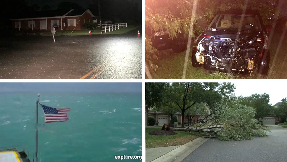
During the 4 p.m. hour, tornado warnings were issued at various times for Johnson, Jones, Onslow, Carteret, Craven, Cumberland and Wilson counties. The warnings have expired.
There were no immediate reports of damage from those areas.
2 p.m. update
Dorian is a top-end Category 2 hurricane as it continues moving toward the north-northeast at 8 mph. The storm is about 60 miles south of Myrtle Beacah, South Carolina and 115 miles south-southwest of Wilmington.
Hurricane warnings remain in effect for the Savannah River to the North Carolina/Virginia border and the Pamlico and Albermarle sounds.
Tropical storm warnings remain in effect for the North Carolina/Virginia borde rto Fenwick Island, Deleware; Chesapeake Bay from Drum Point southward; and Tidal Potamac south of Cobb Island.
Forecasters say Dorian will turn toward the northeast sometime tonight and will pick up forward speed.
It will move near or over the coast of North Carolina tonight and into Friday
11 a.m. update
With the 11 a.m. Thursday advisory, Dorian was moving north at 8 mph, with maximum sustained winds remaining at 110 mph. It was about 50 miles east-southeast of Charleston, S.C., and 140 miles south-southwest of Wilmington. It's anticipated Dorian will turn toward the northeast Thursday night, and its forward speed will increase.
As of 11 a.m. a Tropical Storm Warning was extended northward to Fenwick Island, Delaware, into the Chesapeake Bay to Drum Point, including the Tidal Potomac River south of Cobb Island.
Charleston, South Carolina, is already seeing flooding and high winds. As the storm batters the Charleston area and continues to move north, the Southport Police Department reported via Facebook that the City of Southport has enacted a curfew beginning at noon Thursday. That curfew, the department said, will remain in effect until further notice. Similarly, a curfew is set to take effect in Atlantic Beach beginning at 7 p.m. Thursday. In Carteret County, residents located within the unincorporated areas of the county are subject to a curfew that requires them to remain indoors from dusk to dawn Thursday. The curfew also prevents the sale, consumption or possession of alcoholic beverages except for on a person's own premises. The same applies to firearms and ammunition.
In addition, a number of tornado watches and warnings were issued Thursday as Dorian started its trek up the coast. As of 12:30 p.m., only Bladen and Pender counties remained under a tornado watch.
Fort Bragg road closures
Fort Bragg on Thursday closed roads in order to protect people and property. Those roads are:
- Reilly Road between Butner Road and the Family Readiness Group Center
- The intersection of Watson Street and Log Base Charlie Road
The roads will reopen when deemed safe by engineers.
Dorian is capable of producing damage, not only due to winds, but also due to storm surge and heavy rain. There is also the possibility of isolated tornadoes through Thursday across the coastal Carolinas.
PREVIOUS WARNINGS
The hurricane warning is in effect for all areas on the coast from Savannah River to the North Carolina/Virginia border, including the Albemarle and Pamlico sounds. Essentially, all of the North Carolina coastal counties are under the Hurricane Warning.
These NC counties that are further inland and counties in Central NC are under a Tropical Storm Warning: Bladen, Columbus, Pitt, Greene, Duplin, Lenoir, Robeson, Halifax, Nash, Edgecombe, Johnston, Wilson, Harnett, Wayne, Wake, Scotland, Hoke, Cumberland, Sampson, and Franklin.
The most impact North Carolina is expected to see will be Thursday and continuing into Friday morning. During that time, Dorian is expected to be a Category 2 hurricane. The eye of the storm will either track right along the immediate coast or just offshore.
Gov. Roy Cooper Wednesday urged coastal and inland communities to prepare for storm surge and inland flooding.
"Today is the day to finish preparing. Do not underestimate this dangerous storm," Cooper said. "Listen to your emergency officials and leave now if they have ordered evacuations."
Some locations between I-95 and the coast may see 5 to 10 inches of rain. Rainfall totals should range between 1 and 5 inches from near the Triangle to I-95. West of the Raleigh area, less than an inch of rain is forecast.
Residents of eastern North Carolina, especially near and east of I-95, should be prepared for the possibility of flash flooding. If you live in a flood prone area, it may become necessary to seek shelter on higher ground,
Little to no impact is expected for the Triad and Charlotte areas, based on the latest tracks.
PODCAST: Is N.C. Ready for Another Hurricane? Lessons Learned from Florence.
Listen on Apple | Spotify | Google | Stitcher | RSS
Is North Carolina ready for another big hurricane? Tim Boyum and Ben McNeely are joined this week on the “Tying It Together” podcast by a host of weather experts. Together, they delve into what we learned from Hurricane Florence, and how the state is better prepared for future storms.