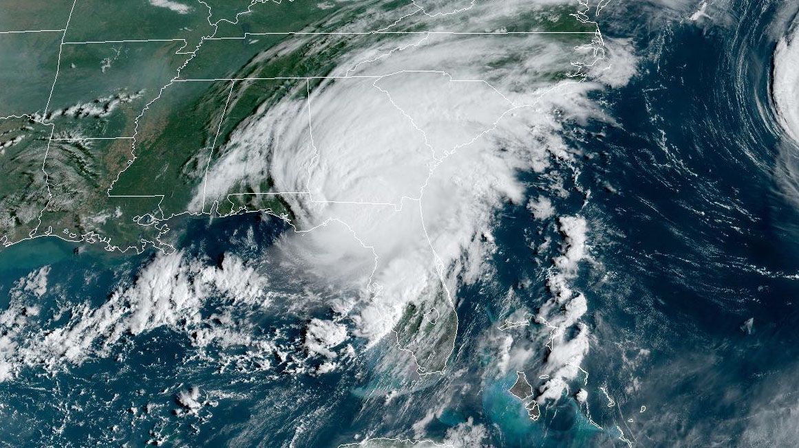
TAMPA, Fla. — Major Hurricane Idalia has made landfall.
The storm and its 125-mph winds made landfall over Keaton Beach. Catastrophic storm surge and winds are expected to continue impacting the Big Bend of Florida.
Idalia continues to move NNE at 18 mph through what has been a favorable environment for intensification. It's located 90 miles northwest of Cedar Key, where "catastrophic storm surge and destructive winds" are expected.
The low-lying marsh area faced a predicted storm surge of up to 15 feet.
A state of emergency is in effect for 49 Florida counties, including:
Alachua, Baker, Bay, Bradford, Brevard, Calhoun, Charlotte, Citrus, Clay, Collier, Columbia, DeSoto, Dixie, Duval, Flagler, Franklin, Gadsden, Gilchrist, Gulf, Hamilton, Hardee, Hernando, Hillsborough, Jefferson, Lafayette, Lake, Lee, Leon, Levy, Liberty, Madison, Manatee, Marion, Nassau, Orange, Osceola, Pasco, Pinellas, Polk, Putnam, Sarasota, Seminole, St. Johns, Sumter, Suwannee, Taylor, Union, Volusia, and Wakulla counties.
Hurricane force winds reach out 25 mph from the center. Rain bands have produced gusts over 60 mph around Tampa Bay. Water levels are still increasing for the Nature Coast. Seven to 11 feet of surge is still expected.
Water levels around Tampa Bay are at 4 feet above the astronomical tide as of 5:30 am. Many roads are flooded. Water levels will stay high all day.
Rain bands can continue to produce tornadoes across the Bay area. A Tornado Watch and a Flood Watch continue.
While the exact track of the center will determine where the worst storm surge will end up, the rain bands will continue to impact the entire region through the morning hours.
That means gusty winds and heavy rain along with a threat of tornadoes. We will monitor Klystron 9 for rotation and to track the center of Idalia as it moves north through the Gulf. Polk, Citrus and Hernando counties were under brief tornado warnings Wednesday morning.
Coastal areas will see the strongest storms, but there will be gusty squalls far inland that rotate around the large circulation of Idalia.
The west coast of Florida is highly susceptible to storm surge so there is a threat of significant, life-threatening impacts.
TIMING:
Tropical storm-force winds are impacting the Tampa Bay area.
WINDS:
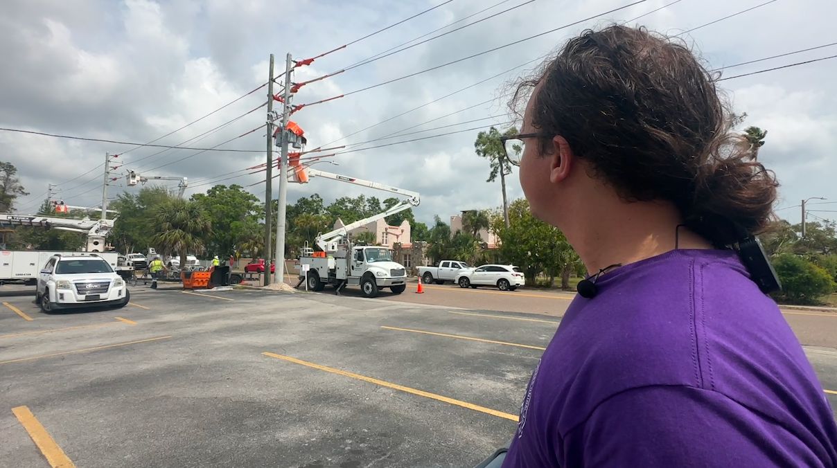
Widespread tropical storm force winds are forecast (39-73 mph), even inland. This will cause downed trees and power outages.
Hurricane force winds (74+) primarily impact the Nature Coast. Any change in the future track will cause changes to the forecast.
TORNADOES:
Models show numerous strong thunderstorms and gusty squalls tomorrow along the coast. Some of these will produce a few fast moving tornadoes.
STORM SURGE FORECAST:
Storm surge will also be a threat to areas along Florida's Gulf Coast. Bay News 9 Meteorologist Juli Marquez states that, "astronomical tides will be high with a full moon, so storm surge will be more impactful."
Storm Surge Warnings are now in effect for from Englewood northward to Indian Pass, including Tampa Bay.
Storm Surge Watches are also in effect for the Florida Gulf Coast from Chokoloskee to Englewood and the mouth of the St. Marys River to South Santee River in South Carolina.
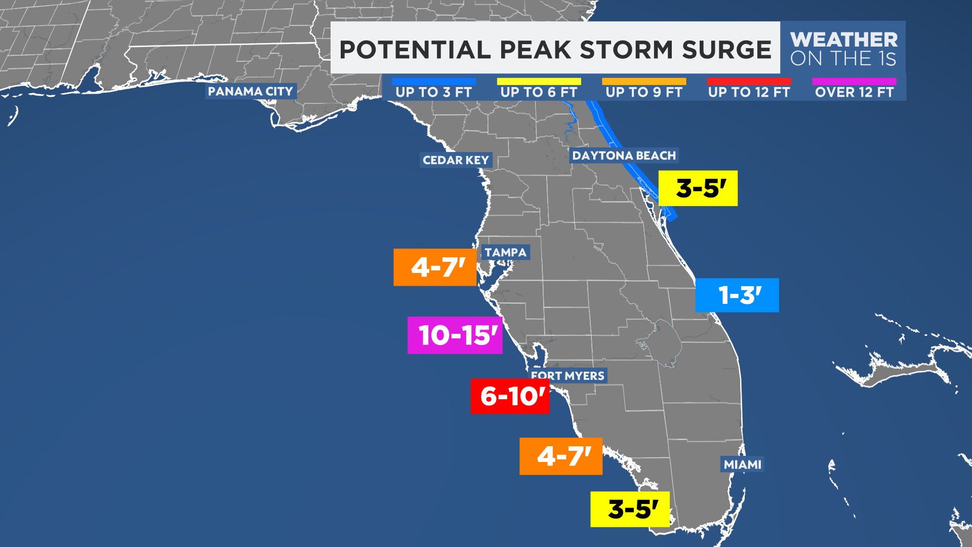
Peak Storm Surge:
Levy/Citrus Counties: 7-11 feet AGL
Hernando/Pasco Counties: 6 to 9 feet AGL
Tampa Bay Area: 4-7 feet AGL on coast, 3-6 feet in Tampa Bay
Sarasota: 3-5 feet
A Flood Watch has been issued for our area. Idalia could bring 4 to 8 inches of rain. Locally higher amounts are possible. This could lead to street flooding and flooding of poor drainage areas.
POTENTIAL IMPACTS ALONG THE NATURE COAST:
- Widespread deep inundation, with storm surge flooding greatly accentuated by powerful battering waves.
- Structural damage to buildings, with many washing away.
- Damage greatly compounded from considerable floating debris. Locations may be uninhabitable for an extended period.
- Near-shore escape routes and secondary roads washed out or severely flooded. Flood control systems and barriers may become stressed.
- Extreme beach erosion. New shoreline cuts possible.
- Massive damage to marinas, docks, boardwalks, and piers.
- Numerous small craft broken away from moorings with many lifted onshore and stranded.

Tides are running much higher than normal due to the Super Moon, which could contribute to a higher storm surge in some areas.
HIGH TIDE FORECAST:
Crystal River:
3:14 p.m. Tues.
4:59 a.m. Wed.
4:09 p.m. Wed.
Ozello:
2:19 p.m. Tues.
4:04 a.m. Wed.
3:14 p.m. Wed.
Bayport:
12:53 p.m. Tues.
2:38 a.m. Wed.
1:46 p.m. Wed.
Tarpon Springs:
11:30 a.m. Tues.
1:23 a.m. Wed.
12:33 p.m. Wed.
Clearwater Beach:
10:47 a.m. Tues.
12:32 a.m. Wed.
11:42 p.m. Wed.
St. Petersburg:
12:54 p.m. Tues.
3:32 a.m. Wed.
1:53 p.m. Wed.
Gulfport:
11:22 p.m. Tues.
2:00 a.m. Wed.
12:21 p.m Wed.