ST. PETERSBURG, Fla. — The National Weather Service released its initial post Hurricane Milton report.
The storm brought devastating impacts to the Bay area, including storm surge south of its eye, flash and river flooding and a trail of wind damage and power outages.
What You Need To Know
- National Weather Service released its initial post Hurricane Milton report
- Storm brought devastating impacts to the Bay area, including storm surge south of its eye, flash and river flooding and a trail of wind damage and power outages
- Post Tropical Cyclone Report (.pdf)
- County Impacts Associated with Hurricane Milton (.pdf)
- PHOTOS: Milton's impacts seen across Florida
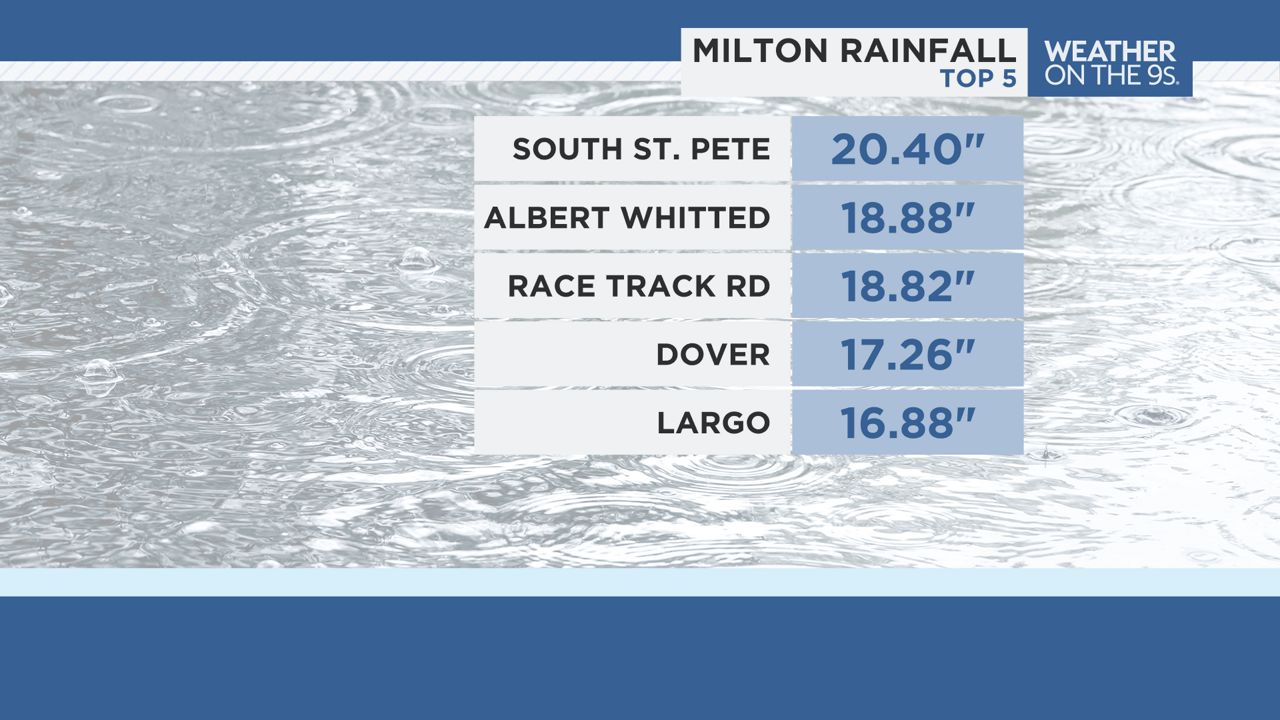
According to the initial report, part of St. Pete saw more than 20 inches of rain during the storm and almost 19 inches of rain was recorded at Albert Whitted Airport.
That shatters the previous 24-hour period record of 6.9 inches set back in 2001.
Meanwhile, in the northwest Hillsborough County area of Westchase near Racetrack Road, an isolated maximum total of almost 19 inches was recorded.

Wind gusts in our area ranged anywhere from 50 miles per hour in Citrus County to over 100 miles per hour in Pinellas and Sarasota counties.
Maximum wind gusts of 102 miles per hour were recorded at the Sarasota-Bradenton International Airport.
The NWS also tracked seven tornadoes in their coverage area in Highlands and Lee counties, but none in our viewing area.
Two EF-2 tornadoes were reported, one in Lee County and one in Highlands County.
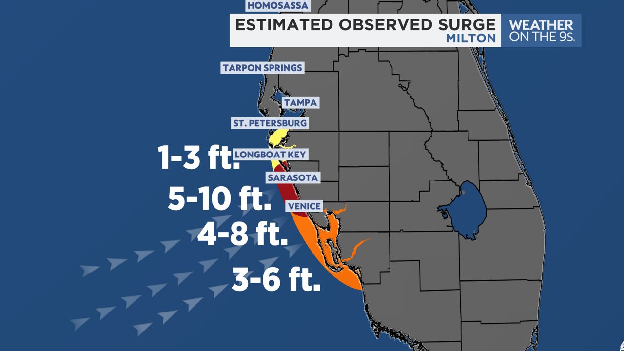
Storm surge also hit mainly south of our area with water levels rising to an estimated 5 to 10 feet above mean high tide in parts of coastal Sarasota County.
A reverse storm surge occured in parts of Tampa Bay and north.

Surge was minimal north of Sarasota County. Coastal Charlotte County saw 4 to 8 feet of surge and coastal Lee County saw 3 to 6 feet of surge.
These are just initial reports and we could see some minor changes and/or additions to these statistics when a final report is released next year.


