April is typically a quiet month around Central Florida but is usually very active in other parts of the country as we transition from Winter to Summer.
The Spring time from March through May is very active with severe weather across parts of the Central and Southern United States.
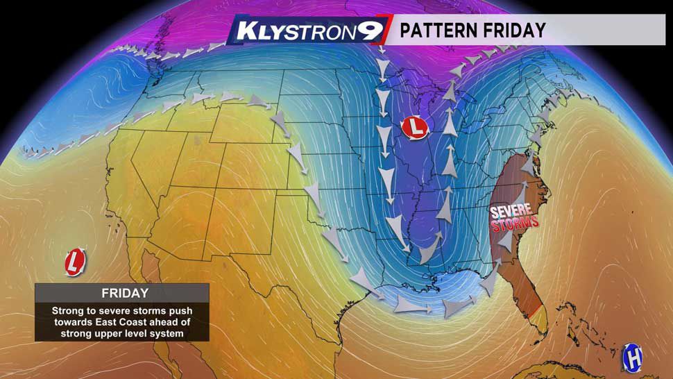
Every now and again, a potent enough storm system can dig far enough south in April to impact the Florida Peninsula. That is what we are watching for Friday.
This afternoon, a storm system, in a few different parts is developing well to our west. A piece of it is in the Southwest U.S. and another in the Upper Midwest. As the system develops in the Southwest and moves northeastward, it will allow a cold pocket of air to move southward from Southern Canada and the Great Lakes.
But, the air in the Southern U.S. has been warm and increasingly humid and that trend will continue Thursday and Friday. A strong cold front will develop and move across the Gulf of Mexico on Friday pushing a line of strong to severe storms into Florida.
The air ahead of the cold front will become very unstable. Our surface winds will increase from the south, pumping in warmth and high humidity. This, combined with the cold pocket of air aloft over the Northern Gulf will lead to a very unstable environment. This next graphic shows the available energy in the atmosphere to support strong thunderstorm development. The yellow and orange color indicate an atmosphere primed for thunderstorm development.
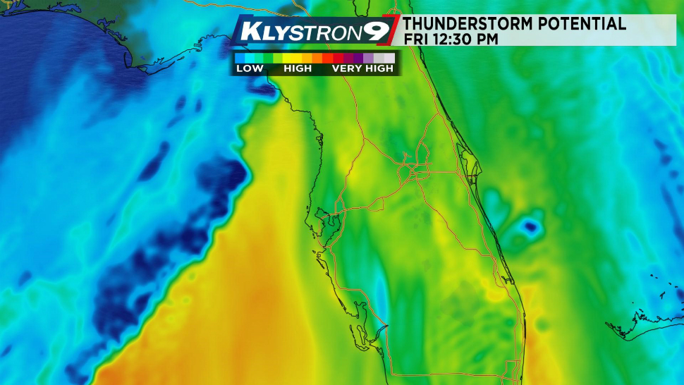
We are still working out the timing of the line of storms for Friday as there is still some subtle disagreement amongst our reliable computer models, but we are leaning toward a mid to late afternoon scenario on Friday. This will lead to problems for the commute home for those working on Good Friday, and also for those heading to the first Passover Seder on Friday evening.
This next image indicates the frequency of lightning along with the surface wind. We see strong southerly wind over West Central Florida with strong west to northwest winds in the Gulf behind the front. There will likely be a higher frequency of lightning as the storms first come on shore in the afternoon.

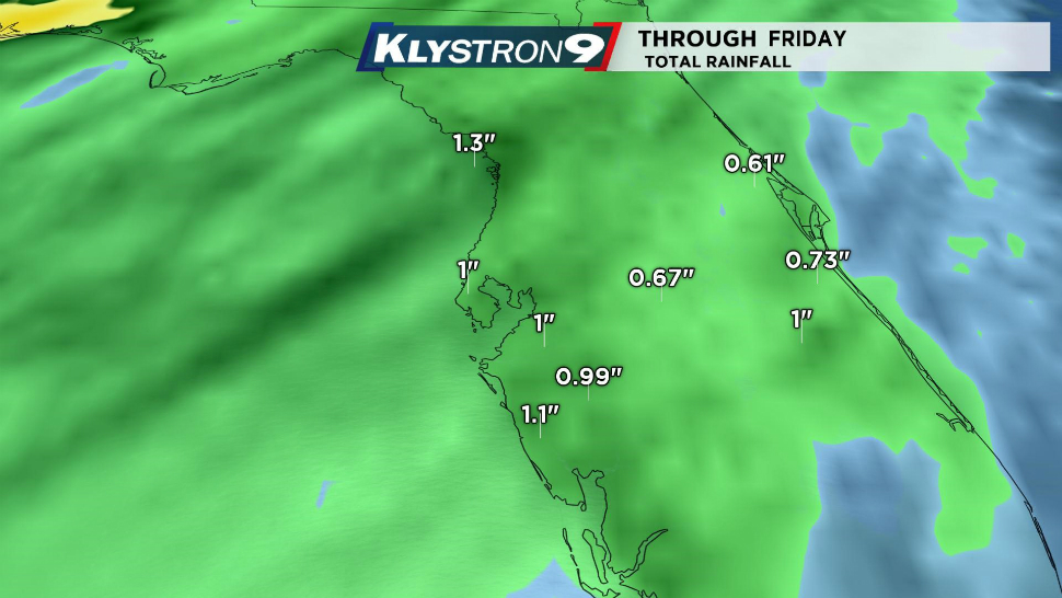
With a strong line of thunderstorms, heavy rainfall is also possible. Most computer models indicate widespread one inch totals across the area.
With all of this said, there are still some nuances to the forecast for Friday. If the line of storms is delayed, we could develop a sea breeze which may lower the instability in coastal land areas. That would diminish the strong to severe threat. Timing differences for inland locations would lead to, again, the amount of potential instability preceding the cold front. Finally, the main concern with the line of storms will be the potential for strong damaging wind and a few isolated tornadoes.
We will be fine tuning the forecast details between now and Friday. This is a good time to download the Spectrum Bay News 9 app to have Klystron9 and Saf T Net alerts in the palm of your hand for Friday.


