Telling you December has been exceptionally warm this year would be like telling you rain is wet. It couldn't be more obvious if you have lived here for many years!
However, just how unusual has this warmth been, and when does Tampa usually reach its coldest week of the year? Those not-so-obvious questions are what we are here to discuss!
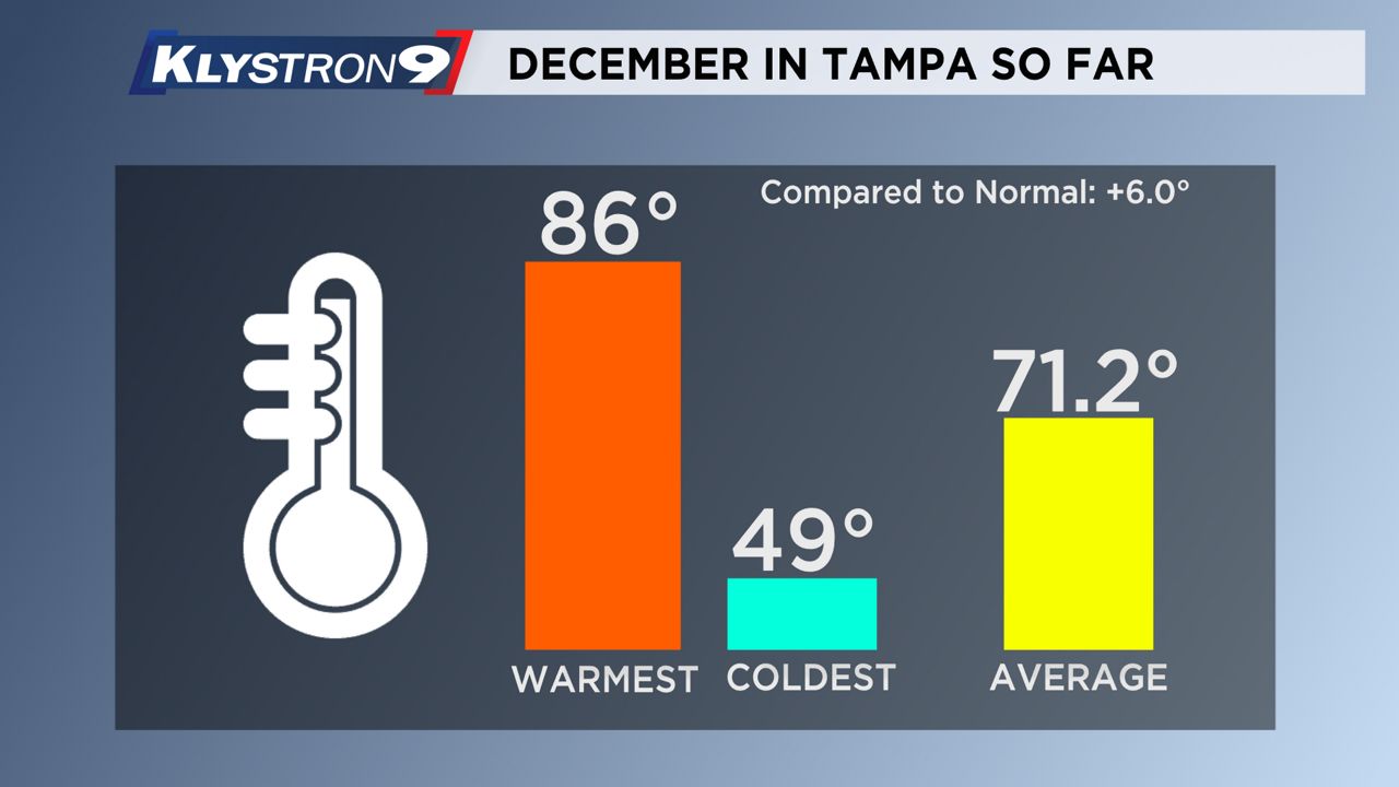
While it's been a warm December in Tampa Bay, there have been some cold spells. Tampa has seen a wide variety of temperatures this month, with a peak of 86 and a low of 49 degrees.
More cold spells will happen! There is plenty of time left in the season! Tampa Bay has seen temperatures as low as 29 degrees as late as March! However, we are entering the few weeks of the year when the temperature is historically at its lowest.
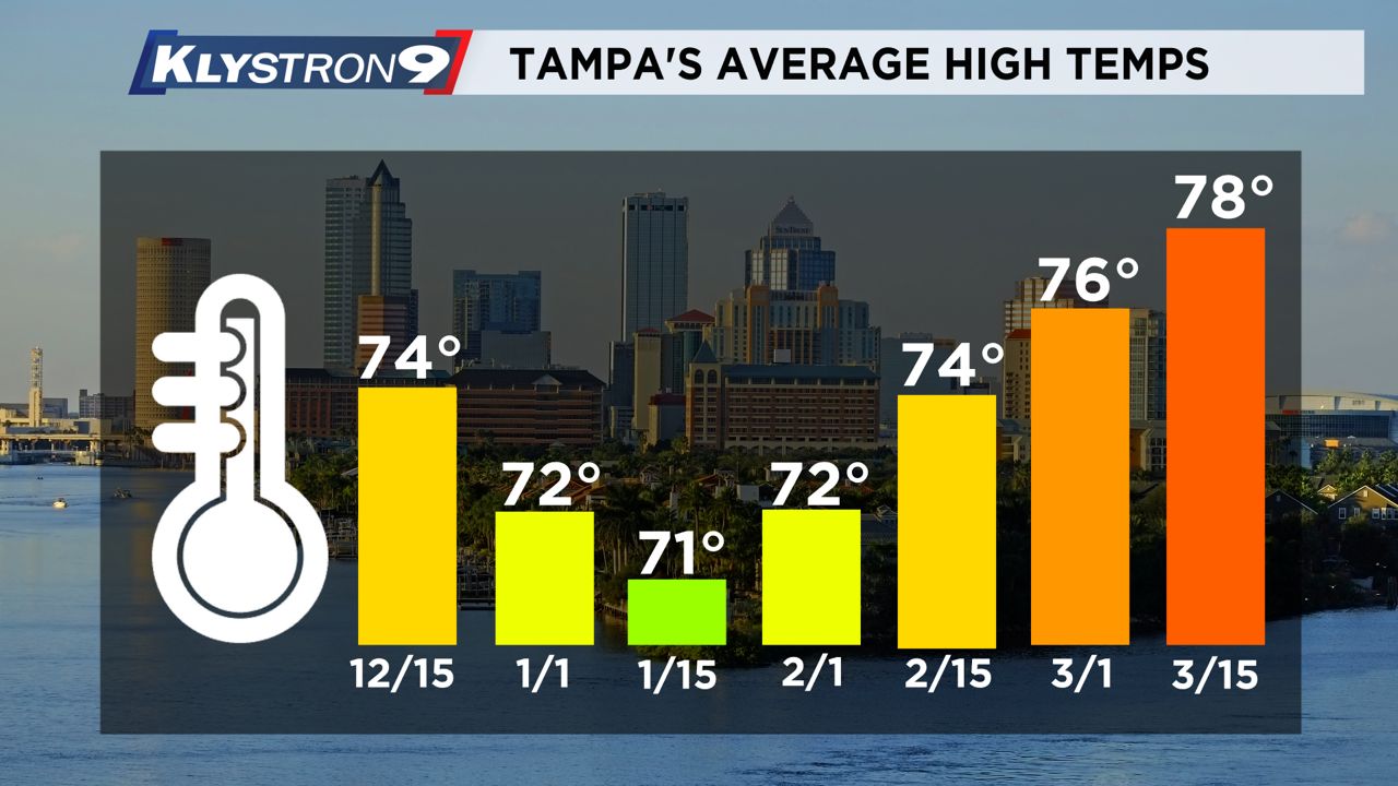
The average high in Tampa this time of year is in the low 70s, and the average high doesn't get much lower than that! For instance, the average high on New Year's Day is 72 degrees, and on Jan. 15, the average high is 71 degrees.
Historically, the second to the third week of January is when Tampa observes its coolest days of the year!
Why do we say that? By February, the average high temperature starts its climb upward! That upward trend continues into summer when the average high reaches the 90-degree range.
Look at Feb. 1. The average high is back to 72, and by March 1, the average high jumps to 76 degrees. These averages are based on the last 30 years of climate data.
Of course, averages are just that, averages. There are always variations day-to-day in what we call weather. Some days will be well above the climate benchmark, while others will fall sharply below it.
This year, more days in December fell well above the seasonal averages, placing Tampa at an impressive 6 degrees above the monthly normal so far. The average monthly temperature in Tampa is about 65 degrees.
That figure comes from the last 30 years of data which factors in the highs and lows of each December day.
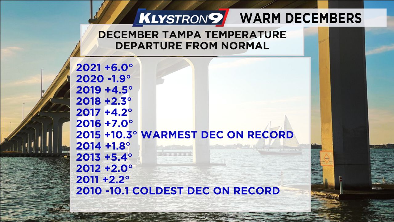
Some Decembers were sharply warmer. Let's look at Dec. 2015, for example. Tampa set fire to December that year, coming in at a whopping 10.3 degrees above average! December 2015 felt more like April in Tampa Bay.
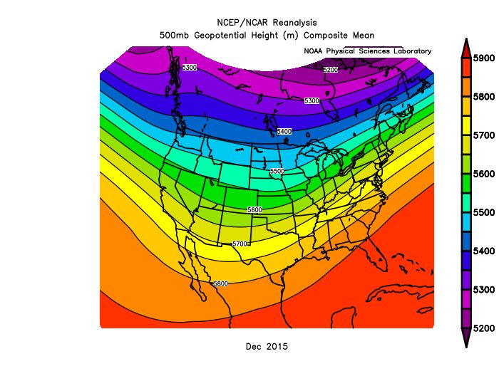
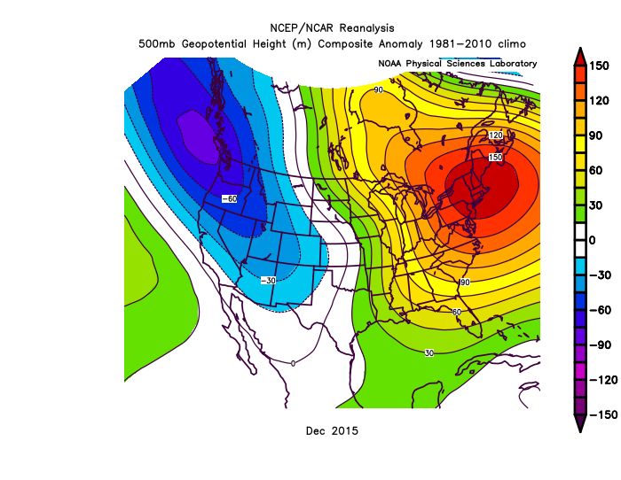
The global pattern was the result of the incredible warmth experienced in Tampa Bay. It wasn't just Tampa Bay. The entire eastern half of the country experienced above-average warmth that December.
The cold air was locked up north, rarely reaching the central and eastern U.S.
The following image will show you the temperature anomalies that year. Even though Florida had temperatures off the charts, the Northeast faced the brunt of the warmth given the pattern that dominated the East Coast.
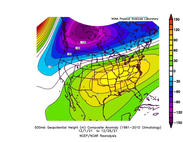
The large-scale pattern that dominated the weather this December also led to unseasonable warmth for much of the East Coast.
While the temperatures weren't extreme by any means, the placement of the high with many other large-scale pattern drivers wedged a ridge of high pressure across the Southeast U.S.
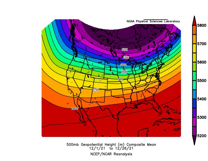
As a result, Dec. 2021 was quite warm for much of the East Coast and Southern Plains. However, the Pacific Northwest has had a very cold and stormy month, as Pacific storms repeatedly moved through with heavy rain and mountain snow.
Before we conclude this article, let's point out one elephant in the room; Dec. 2010. The pattern was a complete reversal from 2015, resulting in jaw-dropping monthly averages for Tampa Bay.
December 2010 closed out with an average temperature of 10.1 degrees BELOW the climatological mean.
Huge variables that drive global patterns such as ENSO, NAO and the AO can enhance or limit cold air outbreaks across the United States.
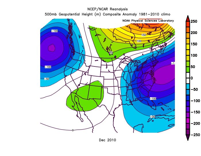
In 2010, Arctic air invaded the United States with one Arctic outbreak after another. A dominant trough was over the eastern United States, and the flood gates were open for business as brutally cold air surged southward.
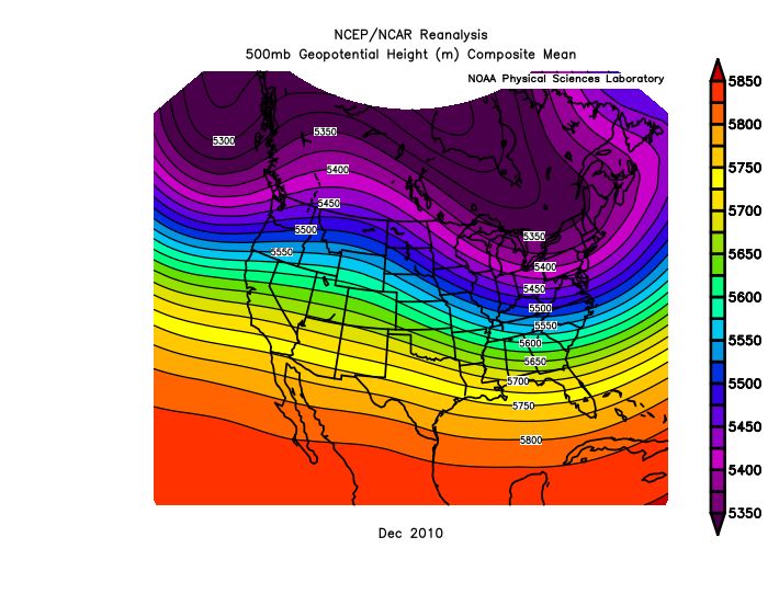
This pattern resulted in a very cold December for the entire East Coast, especially for the mid-Atlantic region.
So the point is, no two Decembers are exactly alike! Some years will favor repeated warmth while others don't relent on the cold! Many times, the pattern will flip, so what starts as a mild winter will quickly switch by the time February rolls around.
Time will tell what the rest of this winter has in store for the Tampa Bay area.
One thing is certain. The coldest week of the year, on average, is just two weeks away! From there, the average daily high temperature will rise as we head straight into summer.


