


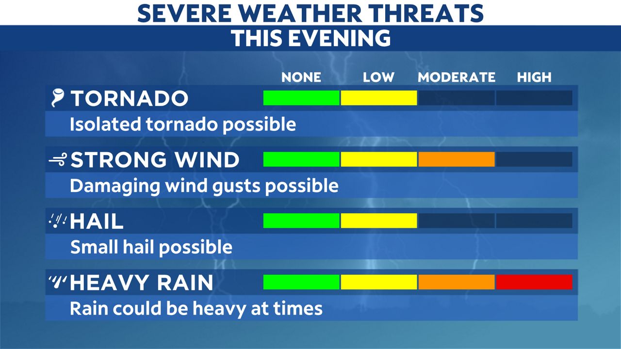
A line of thunderstorms will continue to impact Tampa Bay this evening and a strong or severe storm can't be ruled out.
Storms have been weakening as they approach the coast, but a strong or severe storm in the Bay area can't be ruled out this evening.
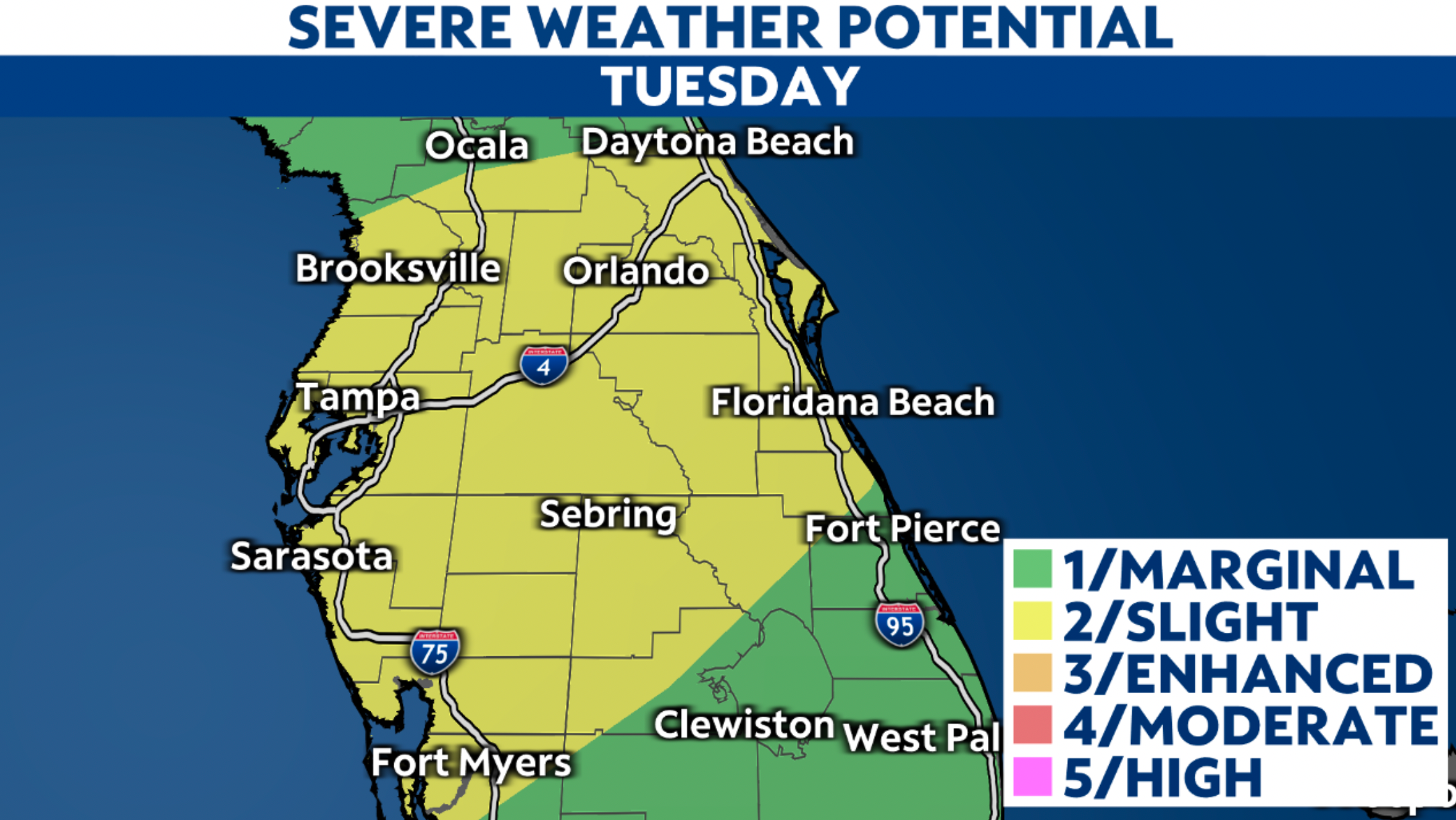
Some storms have already showed signs of rotation, including one that prompted a brief Tornado Warning for eastern parts of Pasco County earlier this evening. While widespread severe weather isn't expected, another spinup or strong wind gusts can't be ruled out.
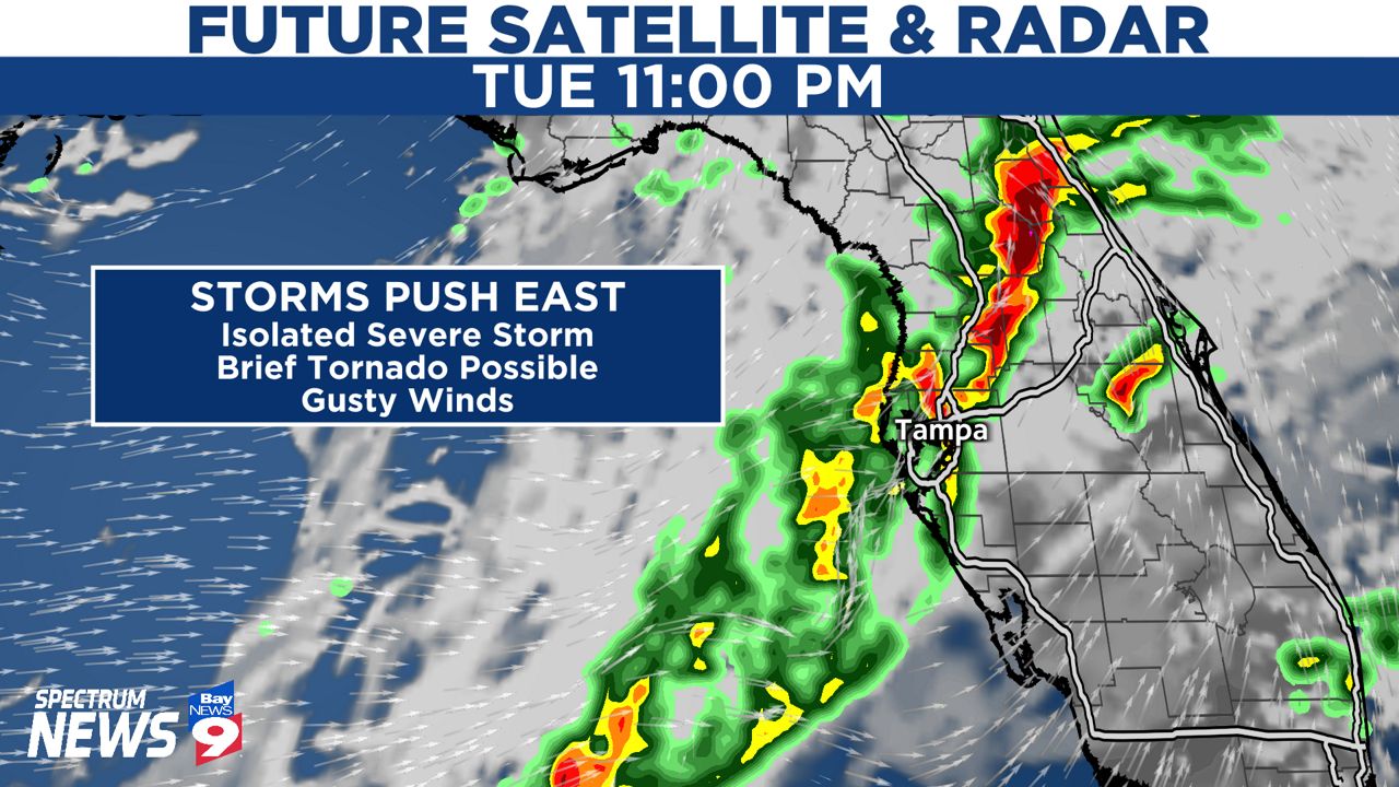
Storms will continue to spread east through the overnight and any risk of severe weather will gradually come to an end. The severe threat will drop off quickly after midnight as the bulk of the storms push east.
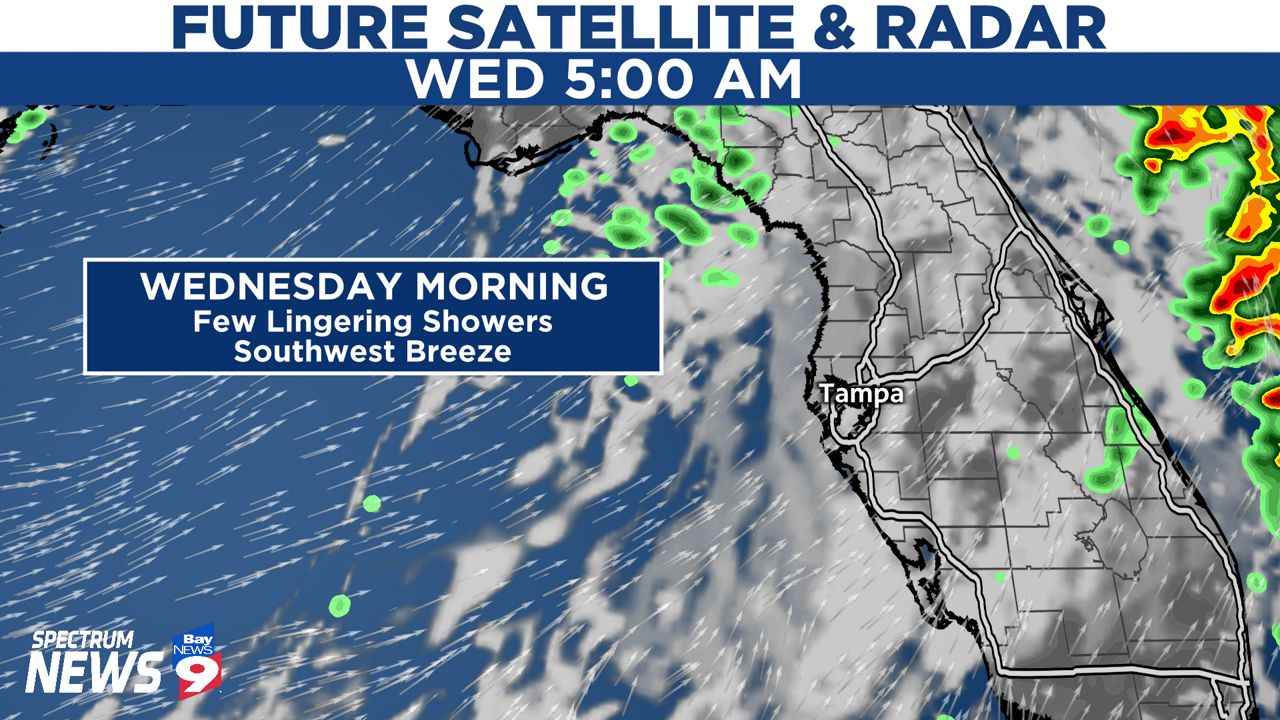
By the time Wednesday morning rolls around, we expect mostly cloudy skies with a few lingering showers possible. This means we don't anticipate any significant weather around Tampa Bay come sunrise Wednesday morning.
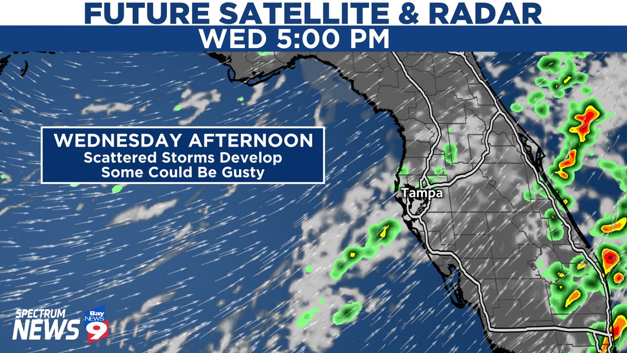
The main cold front will approach Tampa Bay during the afternoon hours on Wednesday. A few storms may develop along it but the threat for severe weather appears minimal at this time.
Either way, any storm that does develop Wednesday afternoon will have the potential to produce gusty winds and heavy rain.
Behind the front, quiet weather returns to Tampa Bay with no storms threatening the area Wednesday night and Thursday.