The dry season has been unusually dry for residents in southern Florida, only receiving a fraction of the seasonal rainfall so far this year.
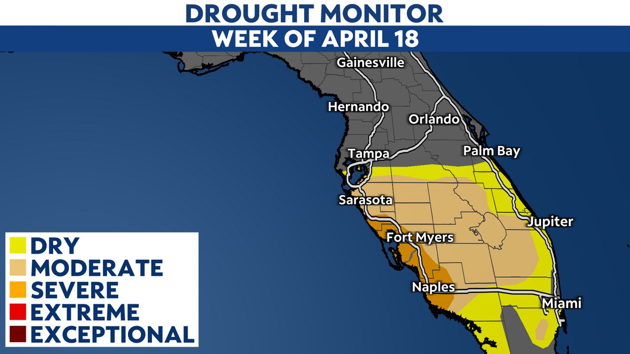
Unusually dry weather for southwest Florida has led to drought. Typically, we don't like showing the drought monitor this time of the year since it is the dry season in Florida.
Rainfall deficits can overturn in a matter of days when the rainy season arrives. During the dry season (November through May), a city may receive 2-3 inches of rain for an entire month, but just one thunderstorm during the rainy season can produce more rain than that.
Having said that, we are approaching the end of Florida's dry season, and some areas have had an exceptionally "dry" dry season.
Soon enough, the combination of daytime heating, tropical air and afternoon sea breezes will be enough to trigger daily storms.
During the dry season, we rely on cold fronts to deliver rain to our area. This year, cold fronts have been responsible for a soaker of a dry season for those living along the Nature Coast.
Since Jan. 1, we have seen I-4 serve as the dividing line between those who have had lots of rain and those who have had very little rain.
Tampa, on the other hand, has been quite normal. Meteorologists calculate what's "normal" by taking the average rainfall totals over the last 30 years. Since Jan. 1, Tampa received about 99% of its typical rainfall.
It's common to see more rain north of Tampa compared to areas south of Tampa. When you think about the driver of rain during the winter and spring months, it makes sense!
Cold fronts are stronger when they enter the state of Florida and weaken as they push south. Stronger cold fronts produce more storms than weak fronts. Therefore, it's expected to see more rain further north when the cold front is stronger.
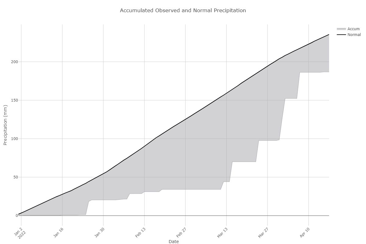
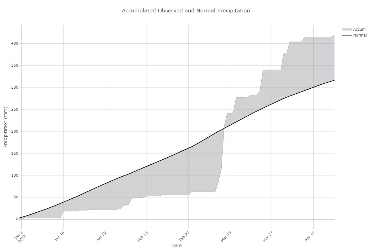
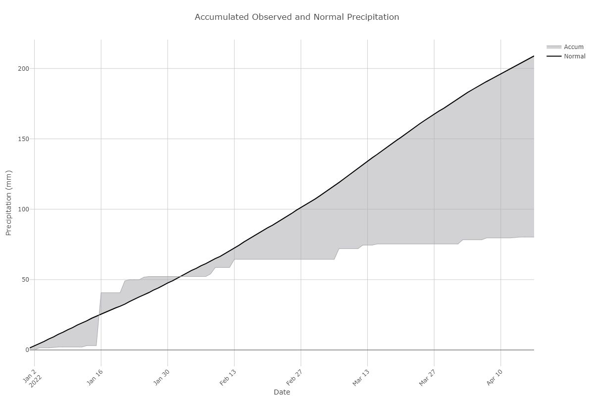
This season especially holds true to that logic but in an exaggerated way. When looking at the numbers this year, the rainfall surplus grows as you head north of Tampa, and the deficit expands as you head south of Tampa.
When analyzed on a graph, the surplus is quite clear based on the Gainesville gauge, especially during the stormy period from late February through March.
For Ft. Myers, though, there wasn't a stormy period at all, which led to the growing deficit in the rainfall.
So what is the big takeaway?
We're seeing severe drought conditions over southwest Florida.
Should we be concerned about that? No, not yet. The upcoming rainy season may turn the deficit to a surplus very quickly. All it takes is one tropical system or a string of thunderstorms to reverse course.
We would be more concerned about drought conditions if we were seeing such deficits grow during the rainy season.
The year is young! We still have plenty of time to make up for the dry weather over southwest Florida.


