A strong cold front came through the area and now windy, colder conditions will persist into this weekend.
What You Need To Know
- Winds will be gusty through Saturday
- Temperatures will be nearly 20 degrees below average
- A freeze is likely for part of the area Saturday night
- Some areas will have a freeze again Sunday night
A line of showers and storms quickly moved through the area. There might be a few sprinkles through tonight, but otherwise drier air is now moving into the region.
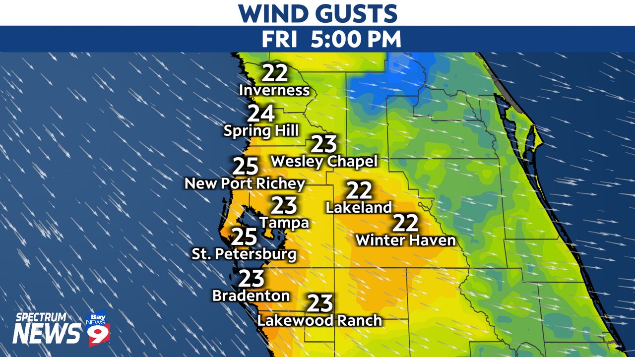
Winds will gust out of the northwest at 20 to 30 mph through Saturday. There will be some lingering clouds moving in from the Gulf, mainly in coastal regions, but expect those clouds to clear out after Saturday morning.
This will usher in much cooler air for the weekend. Despite plenty of sunshine on Saturday, highs will only reach the 50s. Winds will still be breezy, gusting out of the north at around 20 mph.
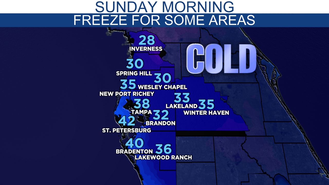
Winds calm down on Saturday night, and this will help temperatures drop even more by Sunday morning.
Lows early on Sunday will fall to the upper 20s to upper 30s around the Tampa Bay area, with a freeze likely for Pasco, Hernando, Citrus, and Levy County.
Sunday afternoon will be sunny, but still cool with highs near 60.