


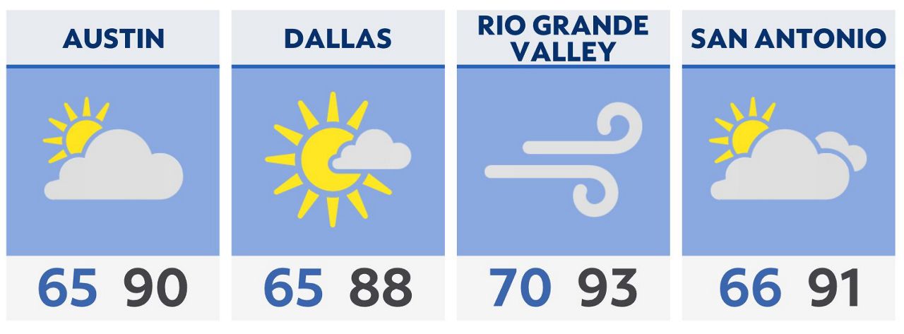
Warm, muggy and breezy again Friday morning with lows in the upper 60s to lower 70s. Skies will remain mostly cloudy with a few sprinkles possible. Rain coverage is less than 10%.
Friday afternoon will be filled with mostly cloudy skies and highs ranging from 87 to 92 degrees. A south wind at 10 to 15 mph will gust as high as 30-25 mph at times.
Rain chances will return to the region Friday night and increase over Easter weekend across much of North and Central Texas.
Multiple rounds of showers and storms are expected as an upper level low and resultant cold front move through.
A few strong storms will be possible late Saturday into Sunday across the state, especially the DFW area where up to 3 inches of rain is possible.
Click here for the latest 7 Day Forecast | Click here to share your weather photos