TAMPA, Fla. — **We are no longer updating this story. For more information on Debby, use this link**
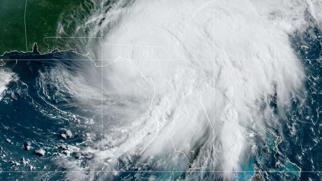
Debby was downgraded from a hurricane to a tropical storm late Monday morning after making landfall in Steinhatchee, along the Big Bend region of Florida's Gulf coast.
The center of circulation crossed the coastline at 7 a.m.
More strong rain bands and gusty winds are expected across much of the peninsula through Monday evening.
Watches/Warnings across Tampa Bay and Central Florida
A Hurricane Warning is in effect for:
- No Hurricane Warnings in the Tampa Bay and Central Florida areas
A Hurricane Watch is in effect for:
- No Hurricane Watches in the Tampa Bay and Central Florida areas
A Tropical Storm Warning is in effect for:
- Citrus County
- Hillsborough County
- Hernando County
- Manatee County
- Pasco County
- Pinellas County
- Sumter County
- Marion County
- Lake County
A Tropical Storm Watch is in effect for:
- Polk County
A Storm Surge Warning is in effect for:
- Citrus County
- Hernando County
- Hillsborough County
- Manatee County
- Pasco County
- Pinellas County

A Tornado Watch is also in effect across the Bay area and most of Central Florida through 6 a.m. Passing storms from the outer bands of Debby will be able to quickly spin up into tornadoes.
Impacts for the Tampa Bay area
Expect 3-7 inches in the Tampa Bay area with higher totals possible, especially north. Rain totals will likely be lower inland.
Significant storm surge is possible along the Nature Coast. The forecast calls for 3-7 feet worst case inundation above ground level. Areas impacted the most will be Crystal River and Bayport, from Hernando and Citrus County northward.
Southward near Tampa Bay, 3 to 4 feet of storm surge is forecasted. This could cause water to rise in normally flood-prone areas around Tampa Bay.
Further north, along the coast of Levy county and the Cedar Key area, a storm surge of 6-10 feet is possible.
A few tornadoes are possible through tonight.
Impacts for the Central Florida area
Central Florida could continue to see squally weather Monday, with locally heavy rain, gusty wind and isolated tornadoes.
Expect much of east central Florida to see between 2 to 4 inches of rainfall on average with locally higher totals up to around 8 inches.
Those farther north and west of Orlando, like Flagler, Marion and Sumter counties, will likely see an average of 5 to 8 inches of rainfall with locally higher totals up to 10 inches in a few spots.
Localized flooding is expected – especially in Marion county which currently has a pretty waterlogged ground from recent sea breeze storms.

Remember, don’t focus too much on the center forecast with a tropical storm of this nature. Most of the significant weather will be to the east of the center, including heavy rainfall.
Be sure to check back often as this system develops.

Our team of meteorologists dives deep into the science of weather and breaks down timely weather data and information. To view more weather and climate stories, check out our weather blogs section.