


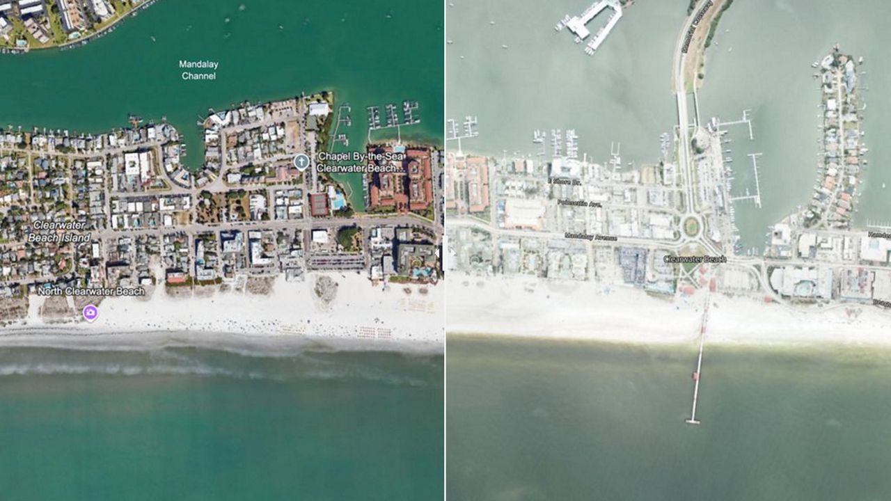
TAMPA, Fla. -- Now that Helene is no more, Floridians have had some time to really get a grasp of the destruction left behind in its wake. One way to see just how bad it was is to take a look at the Florida coastline from the eye of the National Oceanic and Atmospheric Administration's satellite. Below you will be able to use a slider to be able to see images taken well before Hurricane Helene (Google Earth) and after.
- How you can help Hurricane Helene victims in Florida
- FEMA recovery center opens; Bay area residents can apply for assistance
- What to do with all that sand Helene moved into the streets
- Free food, water and tarps being made available for barrier islands residents
- PHOTOS: Helene's impacts seen across Florida