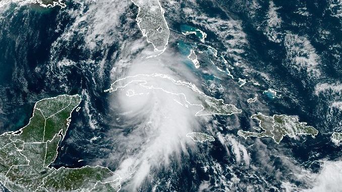
Hurricane Rafael has made landfall in the Cuban province of Artemisa. It's moving inland as a Category 3 hurricane with max winds of 115 mph.
Rafael became a tropical storm on Monday, Nov. 4 and strengthened into a hurricane on Tuesday, Nov. 5.
What You Need To Know
- Hurricane Rafael made landfall in Cuba on Wednesday, Nov. 6
- It made landfall as a Category 3 hurricane
- Rafael will move into the Gulf of Mexico later tonight
Rafael is a Category 3 hurricane with max winds of 115 mph. It's going to move across Cuba as a major hurricane and make it into the southwestern Gulf of Mexico later tonight.
Tropical storm conditions are possible in the Lower and Middle Florida Keys beginning late Wednesday or Wednesday night.
It will move into the Gulf of Mexico tonight and should gradually begin to weaken because of high wind shear and cooler waters. We expect further weakening over the Gulf, well west of Florida, into Friday.
The track has shifted west and impacts are decreasing for Tampa Bay. It will be breezy with scattered showers and thunderstorms, but the highest winds and rainfall amounts will be west of Tampa Bay.
Winds and seas will be hazardous in the Gulf of Mexico. A Small Craft Advisory is in effect for the Eastern Gulf waters later this afternoon through Friday morning. There will be a high risk of rip currents along the Gulf Coast through Friday.

No major impacts are expected in Georgia, Alabama and Mississippi.
A Hurricane Warning is in effect for the Cayman Islands, along with western Cuba.
A Tropical Storm Warning is in effect for central Cuba, the Lower and Middle Florida Keys and the Dry Tortugas.
Check to see how the rest of the 2024 Atlantic hurricane season is going so far.
Our team of meteorologists dives deep into the science of weather and breaks down timely weather data and information. To view more weather and climate stories, check out our weather blogs section.


