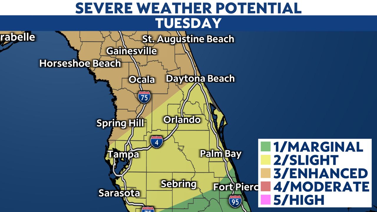
STATEWIDE — As a cold front brings a line of potential severe storms and showers across the state Tuesday, Gov. Ron DeSantis has declared a state of emergency for 49 counties.
Counties included in the executive order are:
Alachua, Baker, Bay, Bradford, Brevard, Calhoun, Citrus, Clay, Columbia, Dixie, Duval, Escambia, Flagler, Franklin, Gadsden, Gilchrist, Gulf, Hamilton, Hernando, Hillsborough, Holmes, Jackson, Jefferson, Lafayette, Lake, Leon, Levy, Liberty, Madison, Marion, Nassau, Okaloosa, Orange, Osceola, Pasco, Pinellas, Polk, Putnam, Santa Rosa, Seminole, Sumter, St. Johns, Suwannee, Taylor, Union, Volusia, Wakulla, Walton, and Washington counties.
Winds will pick up ahead of a cold front Tuesday afternoon, with gusts potentially reaching up to 50 mph.
A line of storms will move through the area between 2 p.m. and 8 p.m., bringing high winds and heavy rain.

Much of Central Florida is under a slight risk (level 2 out of 5) for severe thunderstorms. Although the risk becomes enhanced (level 3 out of 5) for areas farther north.

An isolated tornado or two will also be possible along this line of storms.

A steady south wind could also bring some coastal flooding to the Gulf coast during high tide Tuesday night. A surge of 2 to 3 feet is possible, with some areas to the north potentially seeing up to 4 feet.

Conditions will improve late Tuesday night as winds gradually lessen and rain moves out.
Our team of meteorologists dives deep into the science of weather and breaks down timely weather data and information. To view more weather and climate stories, check out our weather blogs section.


