


The National Weather Service in Ruskin released an updated report on Ian’s observed winds, rain, surge and deaths across the west coast of Florida.
All observations are preliminary.
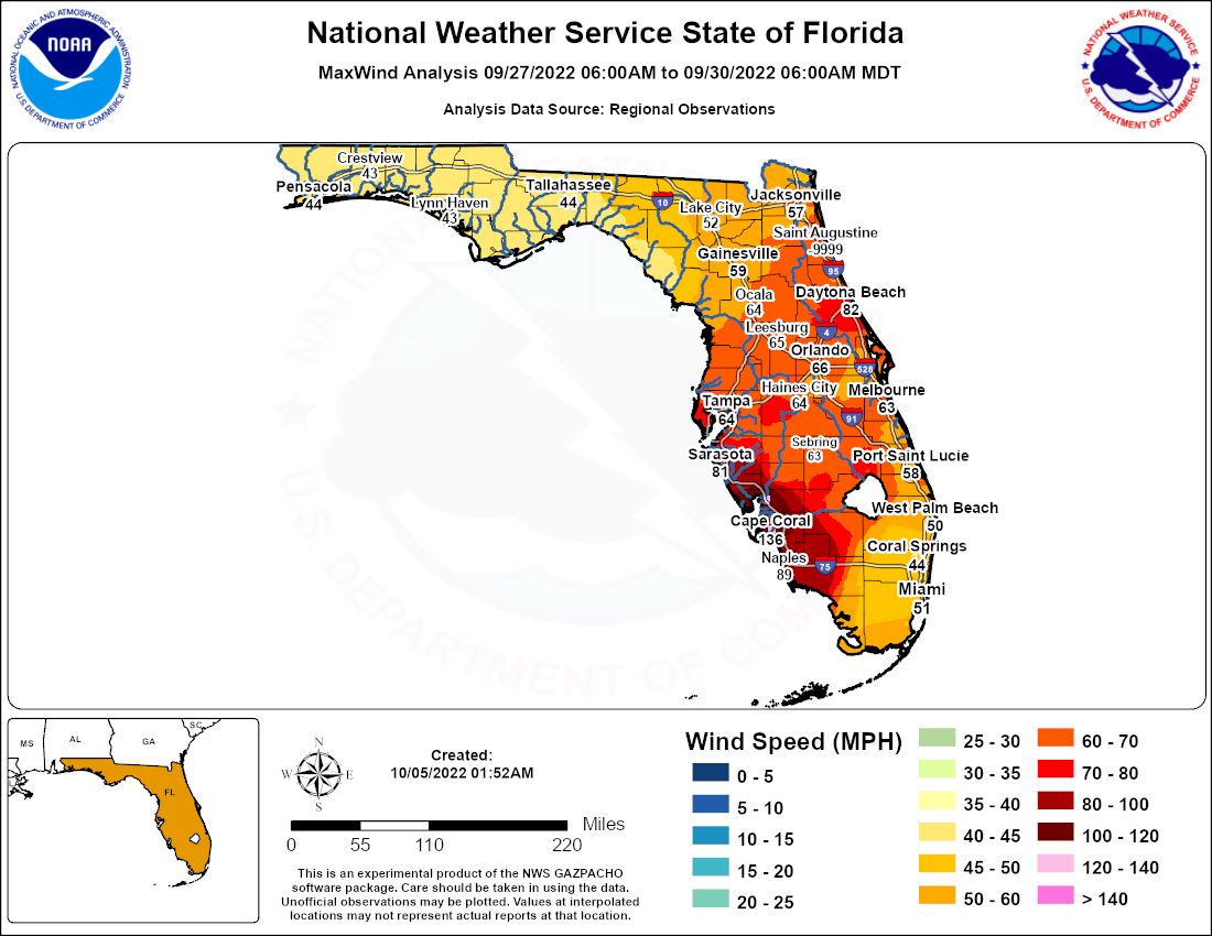
The highest wind gust recorded in the event was 140 mph at Cape Coral Yacht Club. Sustained winds were at 108 mph during the peak of the storm there. Wind gusts peaked at 135 mph in Punta Gorda, with sustained winds of 87 mph.
Here's a list of other notable maximum gusts:
- Fort Myers (SWFL International): 110 mph
- Grove City: 110 mph
- Tarpon Point: 109 mph
- St. Petersburg (Albert Whitted Airport): 77 mph
- Tampa International: 75 mph
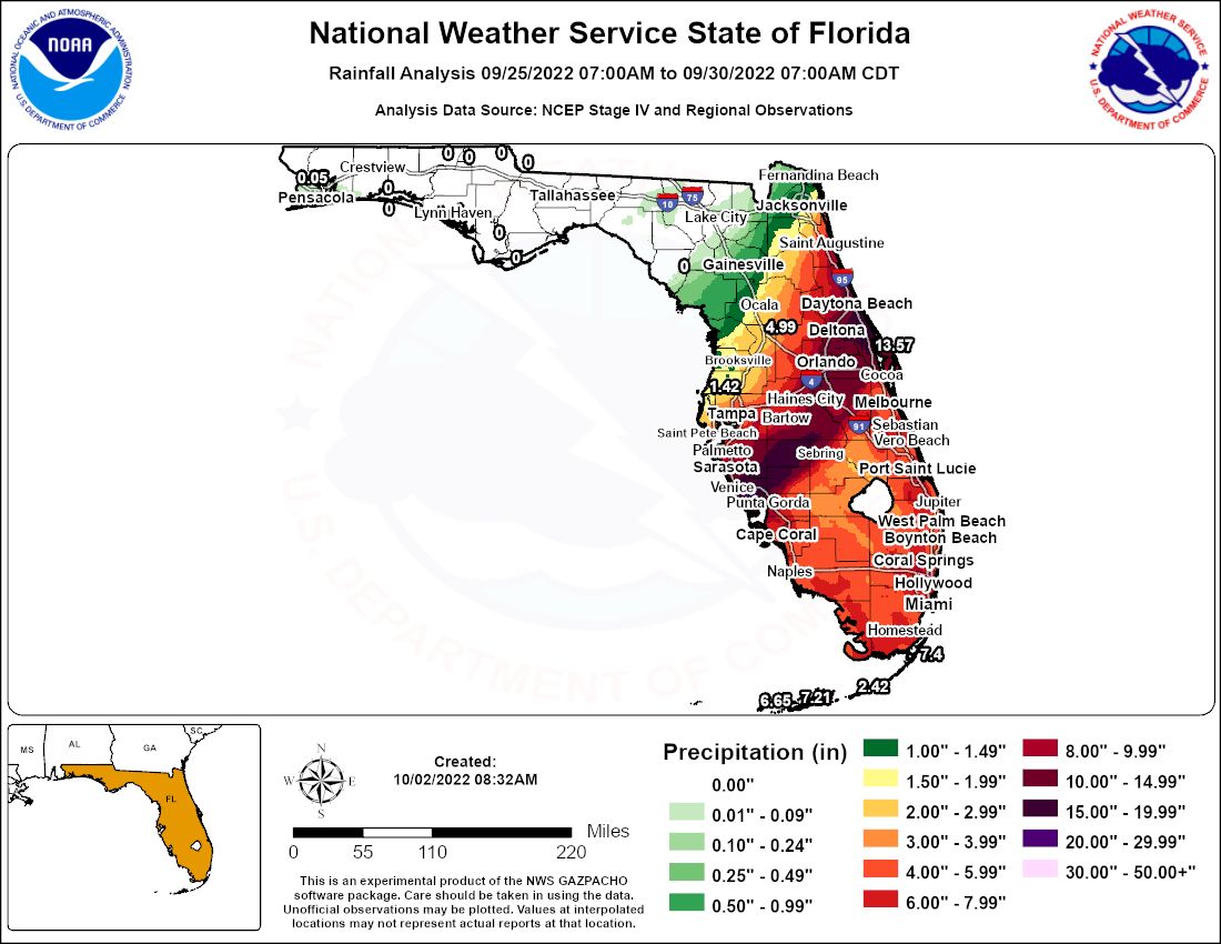
Rainfall was highest south of Tampa Bay in Charlotte, Hardee and Sarasota Counties.
Grove City reported the highest recorded rainfall of the event, with 26.95 inches.
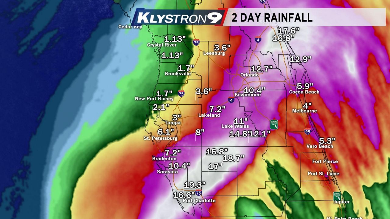
Some other notable rainfall totals include:
- Charlotte Beach: 22.97 in.
- North Port: 21.45 in.
- Zolfo Springs: 20.13 in.
- Pine Level: 19.83 in.
- Lily: 19.31 in.
- South Venice: 18.16 in.
- Myakka City: 15.87 in.
- Frostproof: 11.90 in.
- St. Petersburg (Albert Whitted Airport): 3.34 in.
- Tampa International: 2.55 in.
- St. Pete-Clearwater International: 2.49 in.
Some rivers reported record flooding as all the water drained out into the Gulf of Mexico.
The Myakka River reported a record flood stage of 12.8 feet at Myakka River State Park at midnight on Oct. 1, with the previous record set back in 2003.
The Peace River reached record flood stage at Zolfo Springs on Sept. 29, with a level of 27.2 feet, with the previous record set back in 1933.
Storm surge was greatest just south of where the eye made landfall across coastal Lee County. Unofficial reports from a storm survey in Fort Myers Beach found a peak storm surge of just above 15 feet. The gauge in Fort Myers reported water at 7.94 feet above mean sea level during the peak of the surge.
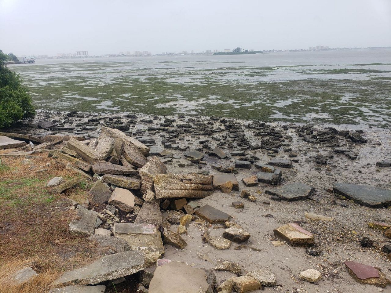
Water levels dropped significantly in Tampa Bay with a strong offshore wind. The East Bay gauge reported water levels to be 7.13 feet below the mean sea level. Water was 5 to 7 feet below mean sea level at its lowest point across much of Tampa Bay.
Even Cedar Key water levels dropped to 5.63 feet below mean sea level.

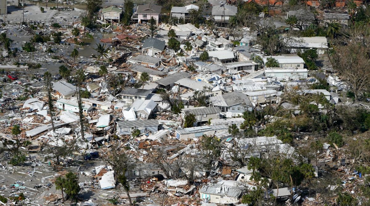
Unfortunately, Ian took many lives across Florida with 52 deaths in Lee County, seven deaths in Sarasota County, five deaths in Charlotte County, four deaths in Hardee County, three deaths in Manatee County, two deaths in Hillsborough County, two deaths in Polk County and one death in DeSoto County.
All reports are preliminary so far, and we may see future changes as more storm surveys come in.
Our team of meteorologists dives deep into the science of weather and breaks down timely weather data and information. To view more weather and climate stories, check out our weather blogs section.