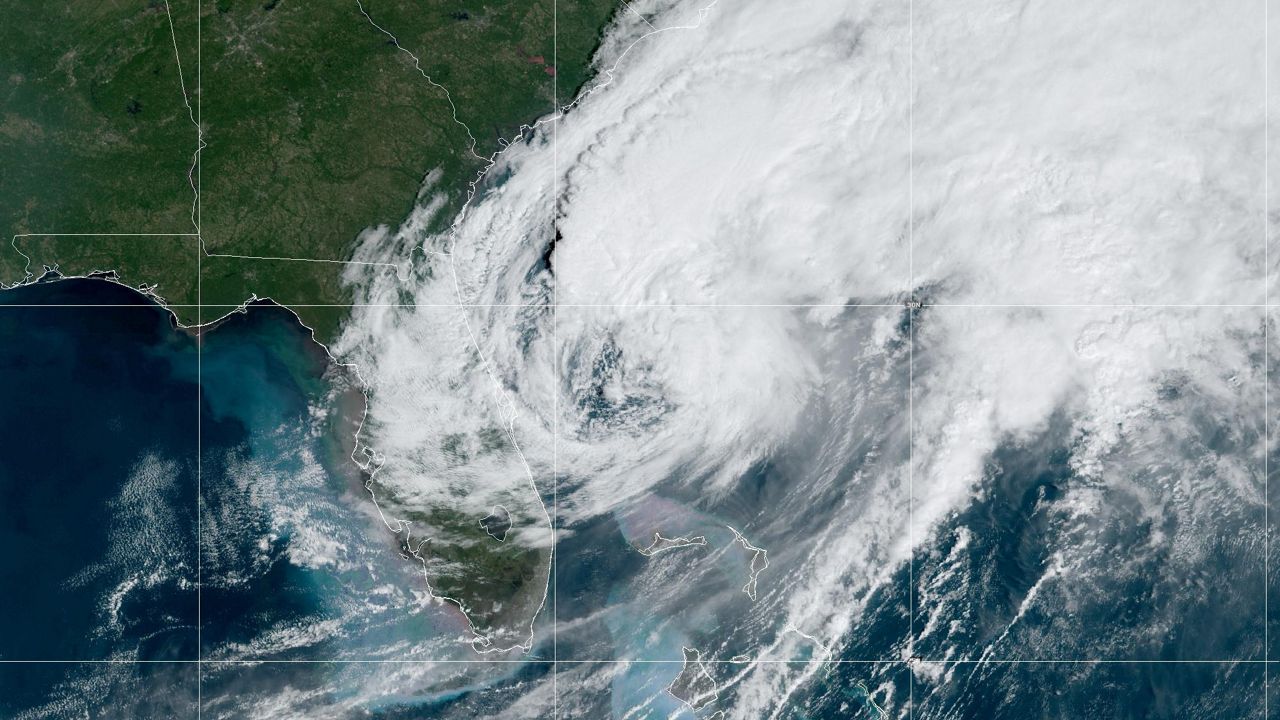
TAMPA, Fla. — Hurricane Milton made landfall as a Category 3 near Siesta Key in Sarasota County Wednesday evening.
Milton's maximum sustained winds have dropped to 80 mph as a Category 1 storm, and has moved off the east coast of Florida, now 135 miles east northeast of Cape Canaveral.
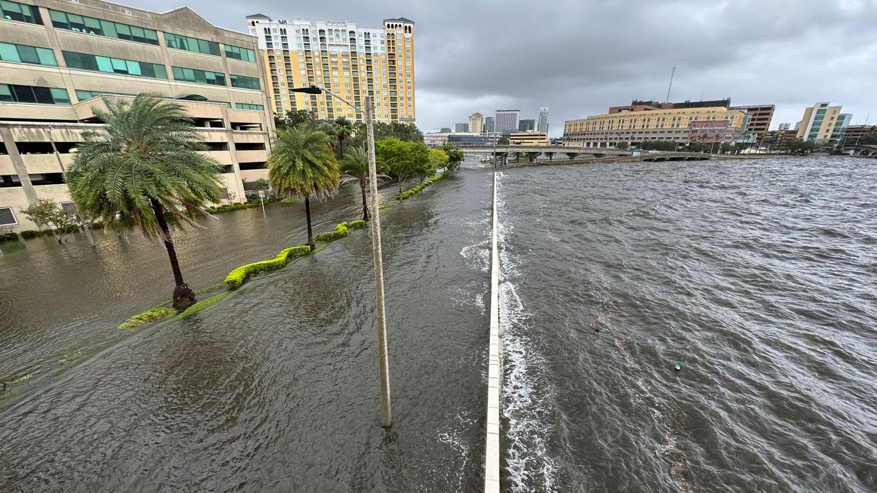
Heavy rainfall and strong winds will continue across Central Florida around and north of Milton's center, while storm surge remains concern after it moves off the coast.
View all Bay area alerts here | View Central Florida alerts here | Central Florida's power outage maps | Tampa Bay's power outage maps
The winds will still be strong far from the center in all directions with some gusts in the 80 to 110 mph range even 30 to 40 miles away from the center.
Milton was steered by the flow between a trough digging over the Gulf of Mexico and a ridge near the Greater Antilles. It moved in a more easterly direction on Thursday.
Right now, hurricane force winds extend 35 miles from the center and tropical storm force winds extend 255 miles from the center, especially to the north. Milton's wind field is expected to grow considerably in size by the time the center moves over Florida with a large region of tropical storm and hurricane force winds. Damaging winds, life-threatening storm surge, and heavy rainfall will extend well outside the forecast cone.
The rainfall will bring the threat of flash flooding along with moderate to major river flooding.
The weather should improve quickly on Thursday afternoon.
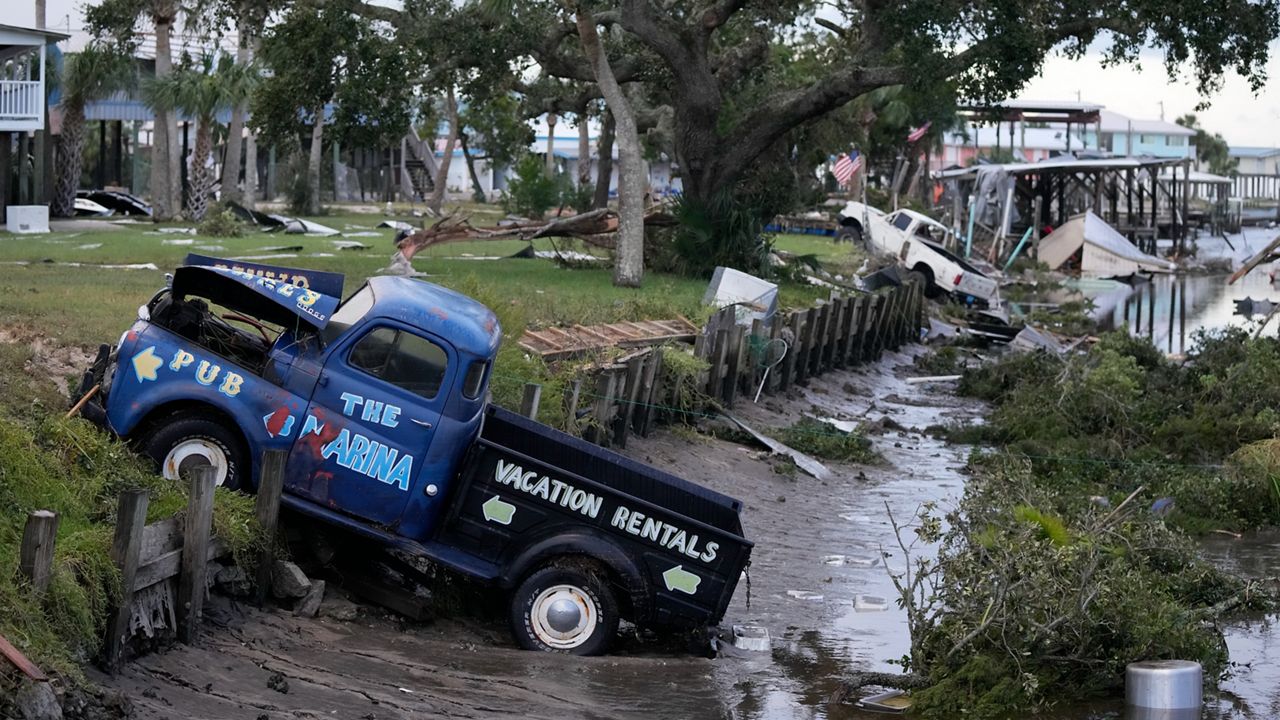
Expect extensive wind damage and power outages near the center of the storm.
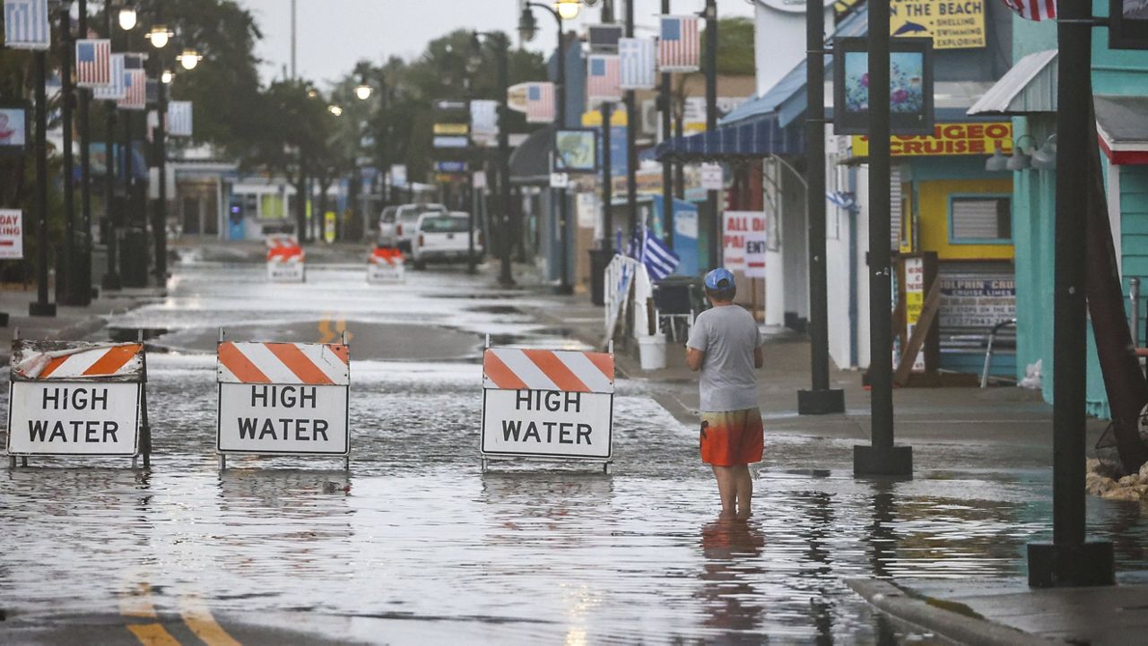
The Tampa Bay area is in a Flood Watch through Thursday evening.
With clean-up efforts and debris removal still very much underway along the west coast, the impacts of heavy rain, wind, and storm surge would be higher.
ADVISORIES/WATCHES/WARNINGS
Hurricane Warnings in Tampa Bay: Pinellas, Citrus, Hernando, Pasco, Hillsborough, Manatee, and Polk counties.
Hurricane Warnings in Central Florida: Marion, Sumter, Northern and Souther Lake, Orange, Seminole, Osceola, Brevard, Volusia, and Flagler counties.
Storm Surge Warning in Tampa Bay: Pinellas, Citrus, Hernando, Pasco, Hillsborough, Manatee, and Hernando counties.
Storm Surge Warning in Central Florida: Brevard, Volusia and Flagler counties.

TIMING FOR POTENTIONAL IMPACTS IN CENTRAL FLORIDA
Heavy rain, damaging winds, and a risk for tornadoes will increase into early Thursday before the storm moves off the east coast by late Thursday morning. Our east coast beaches will likely experience rough surf and beach erosion through the end of the week.
Milton will exit the east coast but winds on the back side of the storm will lead to storm surge and coastal flooding. Storm surge watches extend up and down the east coast.
Flooding will be one of the primary hazards. The highest rainfall totals will be up to 8 to 12 inches, with locally higher totals possible along I-4 and northward.
Rainfall Potential

River Flooding
Heavy rainfall is leading to high river levels and flooding potential. The following areas are under Flood Warnings.
RIVER FLOOD WARNING for Anclote River at Elfers at Little Road. Major flooding is forecast. This approaches the flood of record. At 24.0 feet homes in Anclote River Estates flood. The river is expected to rise above flood stage late tomorrow morning and continue rising to a crest of 25.9 feet Friday evening.
FLOOD WARNING now in effect from this evening to late Friday for the Manatee River at Rye Bridge. Moderate flooding is forecast. At 12.8 feet, Water reaches the roadbed of the Old Rye Bridge. The river is expected to rise above flood stage late this evening to a crest of 13.0 feet tomorrow evening. It will then fall below flood stage Friday afternoon.
FLOOD WARNING now in effect for Little Manatee River at Wimauma at US 301. Major flooding 20.0 feet. is forecast. This approaches the flood of record. The river is expected to rise above flood stage and continue rising to a crest of 18.3 feet early Friday morning.
FLOOD WARNING now in effect for Peace River at Bartow. The river is expected to rise above flood stage late this evening and continue rising to 9.6 feet Saturday morning. Additional rises are possible thereafter. This approaches the flood of record.
FLOOD WARNING now in effect for the Manatee River at Rye Bridge. Moderate flooding is forecast. The river is expected to rise above flood stage just after midnight tonight to a crest of 12.8 feet early tomorrow afternoon.