


A cold front has moved through the area and temperatures will continue to drop through Wednesday night.
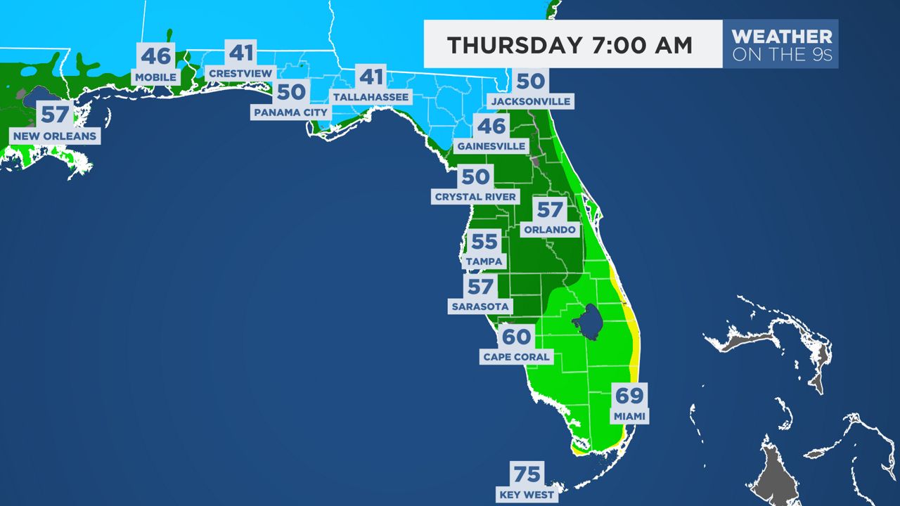
Overnight and into Thursday morning temperatures will fall to the mid to upper 50s around Tampa Bay with some upper 40s to low 50s possible north.
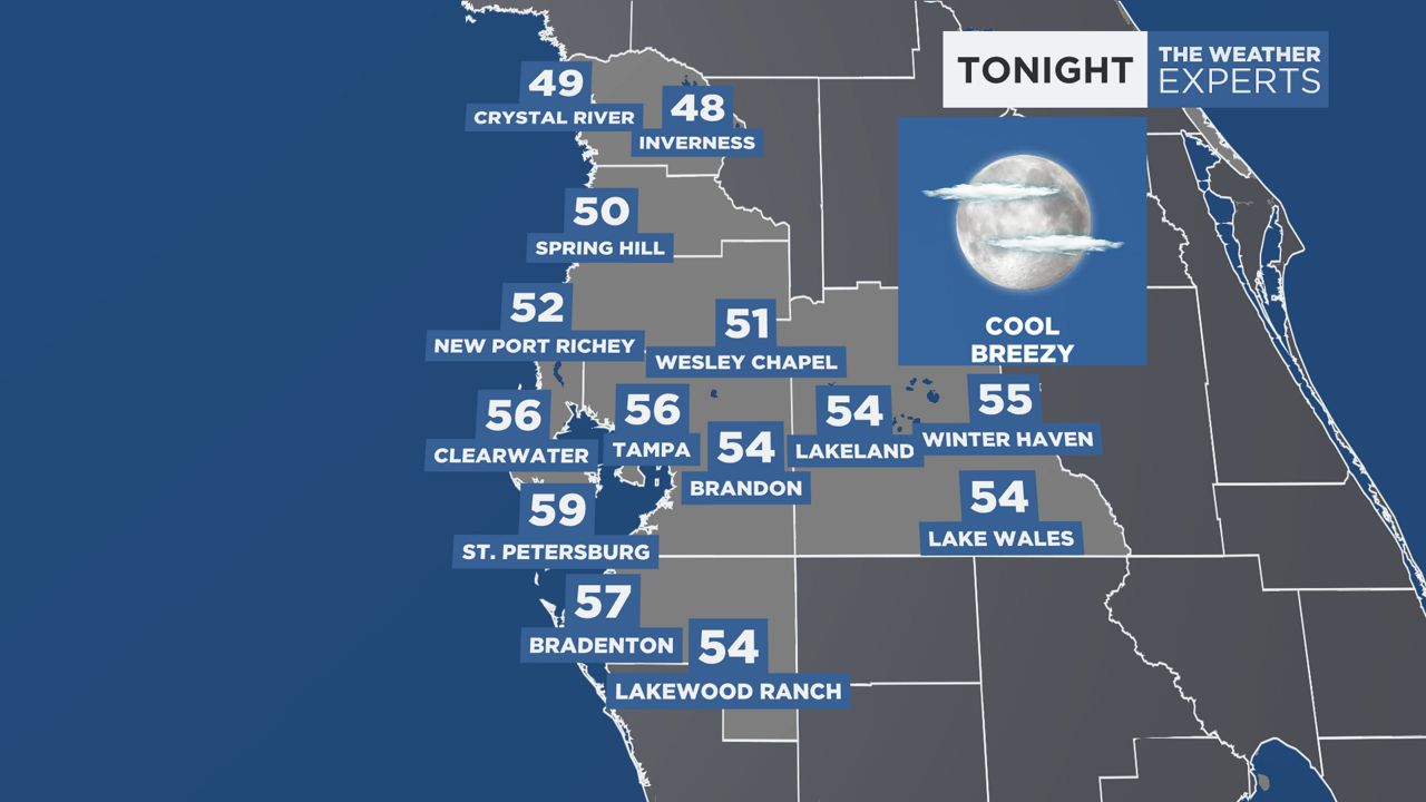
Our typical first sub 60 low occurs on Oct. 23 in Tampa, so this is slightly ahead of schedule. We will also drop at least a few degrees below 60.
If we manage to drop to 56 degrees in Tampa, it will be the coolest we have been since March 21 and the earliest 56 degree reading since 2009.
Some areas in the far northern parts of Florida could see low 40s early Thursday morning.
Expect plenty of sunshine and low humidity on Thursday with afternoon temperatures in the mid to upper 70s.
Humidity stays low and mornings and evenings will stay on the cooler side through the weekend.
A stiff breeze out of the northeast will be persistent into early next week.
Our team of meteorologists dives deep into the science of weather and breaks down timely weather data and information. To view more weather and climate stories, check out our weather blogs section.